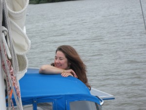
It’s been a few years coming. A few years ago I attempted to sail Godot, my old Seafarer 24 to Martha’s Vineyard, and got turned back by weather. Last year, with my new boat Seeker, I had planned on doing it again; but it took much too long to finish the electrical work, among other things, that I was working on. This year, finally, SUCCESS! One month, 715 nautical miles, and tons of adventure later, with my gal Lauren at my side, the trip I’ve been looking forward to for years has come to a close.
I’m ready to go again.
Here’s the trip log:
Day 0 (July 17, 2014): Delayed
Engine trouble. Not getting out of here today. Tomorrow, hopefully (if the part I ordered is the only thing wrong).
I changed the oil and replaced the fuel filters. When bleeding the fuel system I busted the bleed screw on the secondary filter.
Ugh. I need a beer.
Day 1 (July 18, 2014): Underway!
Adam's Spot
 Latitude:39.32419
 Longitude:-76.40085
 GPS location Date/Time:07/18/2014 10:29:07 EDT

 Message:Seeker has left the dock. We are on our way!
Adam's Spot
 Latitude:39.47253
 Longitude:-75.91977
 GPS location Date/Time:07/18/2014 18:21:21 EDT

 Message:anchored in Veazy cove. C&D canal tomorrow.

 Click the link below to see where I am located.
 http://fms.ws/I4sbv/39.47253N/75.91977W
Day one on our trip north, after a one day late start…
This morning I awoke at 6:30, jumped in the car, and got to the Yanmar dealer in Annapolis just when they opened up. I got the stupid bleed screw back to the boat, a quick engine repair, water tank fill, and ice replenishment later, we left the dock right around 10:30 AM.
Around 10:50 the engine died.
Tightened things, re-bled the system, and we were underway before long.
Not far from Pooles Island, the engine died again.
 Frustrating, to be sure. So, we check the fuel system front to back and notice a lot of gunk in the Racor pre-filter’s water separator. Oddly, when I was doing engine maintenance in prep for this trip I didn’t change this filter out (I’m not sure what I was thinking), so a quarter mile from Pooles Island it got done. And the engine worked!
Mostly anyhow. Periodically during the day the engine would lose RPMs, and after a few minutes would start running OK. Not too far from our anchorage for the evening the motor did slow enough to stall out. I bled the system (I’m getting really good at it…it took less than three minutes and I’m sure I can cut that in half), and the engine worked perfectly for the rest of the day.
We are now happily anchored in a little cove called Veazey off of the mouth of the Bohemia River, a short trip to the C&D canal. Lauren is making dinner as I type. I’m thinking a little swim might be in order later.
But what about tomorrow? We must transit the C&D under power.
I think we are going to go for it. What ever the problem is, bleeding the system seems to make the engine run fine. At least for awhile. Air is getting in somewhere (I suspect through the fuel filter…perhaps it needs a new O-ring), and I swear I’ll find the culprit eventually. In the meantime, if we need to do a fire drill every few hours I think we’ll be fine. Honestly, at this point I think we can bleed the fuel system before we lose steerage.
Not ideal, maybe; but that is what adventure is all about. Over coming obstacles.
Day 2 (July 19, 2014): C&D Canal
Adam's Spot
 Latitude:39.33265
 Longitude:-75.33337
 GPS location Date/Time:07/19/2014 21:41:32 EDT

 Message:anchored after eventful day. cape may tomrw

 Click the link below to see where I am located.
 http://fms.ws/I6Qep/39.33265N/75.33337W
I’m tired. I’ll write this quickly while everything is fresh in my head; but coherence may suffer tonight…
For those boaters with reliable engines, I have three words for you…
I. Hate. You.
Really.
No, not really. I am however a little envious.

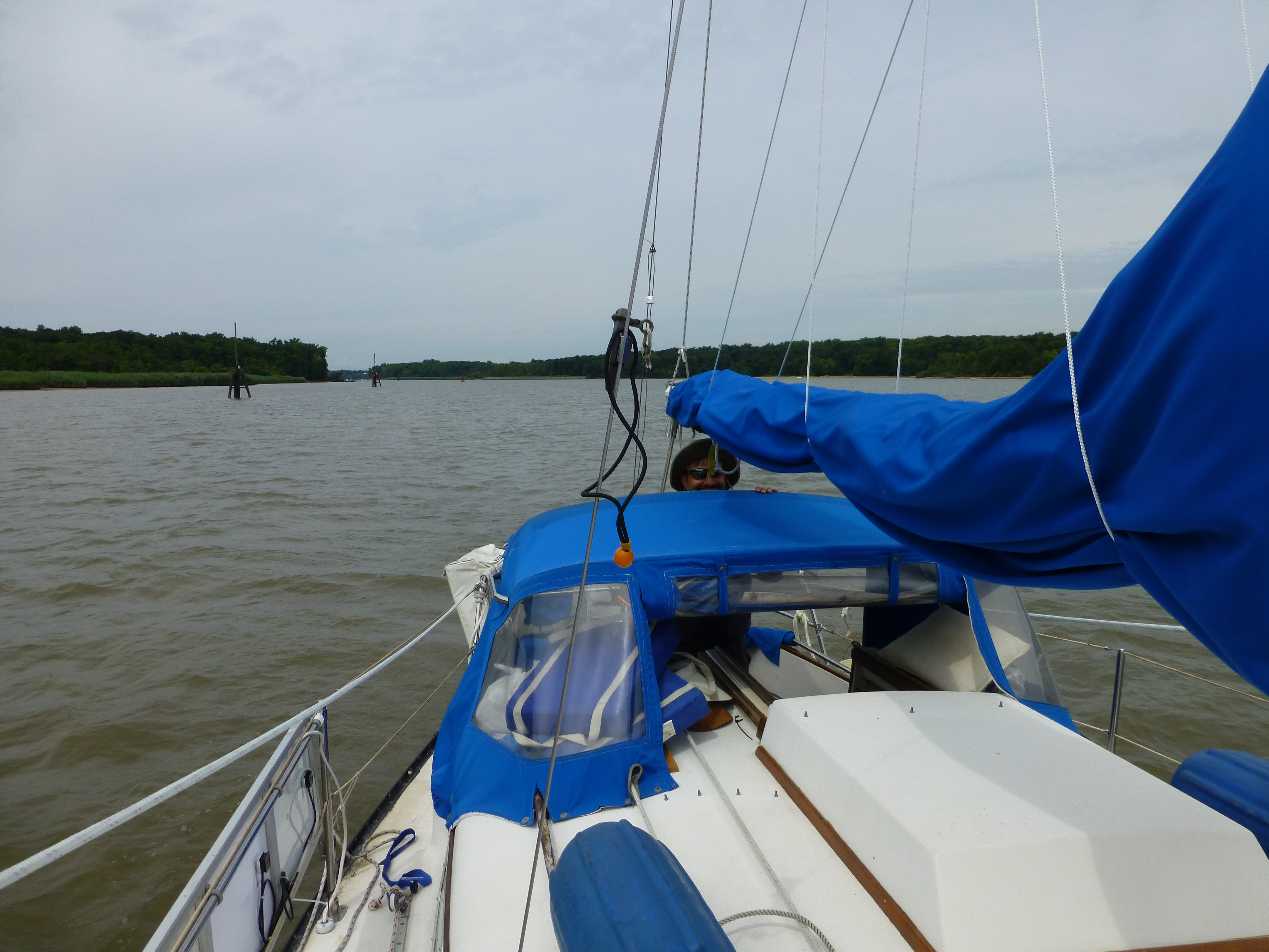
Transiting the C&D Canal
Today we made it through the C&D canal. The engine only failed twice, or maybe three times, going through the canal. At one point we were about to go under a bridge, which was a little dicey. But I am getting really good at bleeding the engine and can usually get it running within a couple of minutes.
On the way into the canal we were beset by forty or more high performance boats zipping out on a poker run, with spotter helicopters chasing from probably thirty feet off the deck. Woke us up for certain.
We did get waked pretty bad by an inconsiderate family in an overpowered cruising boat. We probably rolled thirty degrees port to thirty degrees starboard a dozen times. Anything not strapped down (and a lot wasn’t…we were in the canal, not open water after all) was thrown across the cabin. A bottle of blueberry juice was amongst the litter. The juice sprayed across the entire cabin, including the ceiling. We were annoyed.
Happily, the rest of the canal was a pleasant experience. Unhappily, it is really hard to talk about things that are boringly pleasant. Clearly, bad news is more interesting.
Our intent today was to stop behind Reedy Island (on the Delaware River) for the night. We got there so early, though, that stopping just seemed silly, so we decided to keep on going to shorten what would otherwise be a very long leg to Cape May.
I’ve been spoiled sailing the Chesapeake. I forgot about currents. The Delaware River was at times running north of two knots against us. It didn’t turn to our favor until late in the day. This made progress slow. With light winds, and a fluky engine, progress was really really slow. By 18:00, the wind had filled in a bit, and the tide had turned so when the engine next failed we just decided to leave it off and deal with it in the morning. Around 20:30 we made it to our home for the night, the rather exposed, but adequate Cohansey Cove. We anchored (under sail) on the eastern side to protect ourselves from the expected NE winds. So far it seems fine. I let out lots of scope on the anchor, just in case.
Tomorrow morning I’m going to make another attempt at figuring out what is going on with the engine, and then we are off to Cape May.
Day 3 (July 20, 2014): Cape May, NJ
 Adam's Spot
 Latitude:38.95111
 Longitude:-74.90582
 GPS location Date/Time:07/20/2014 17:16:53 EDT

 Message:cape may safe and sound.

 Click the link below to see where I am located.
 http://fms.ws/I7NFJ/38.95111N/74.90582W
We made it to Cape May. We dealt with the engine problem by just not using it (until the Cape May canal, of course, when it failed once…it was quick to restart).
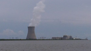
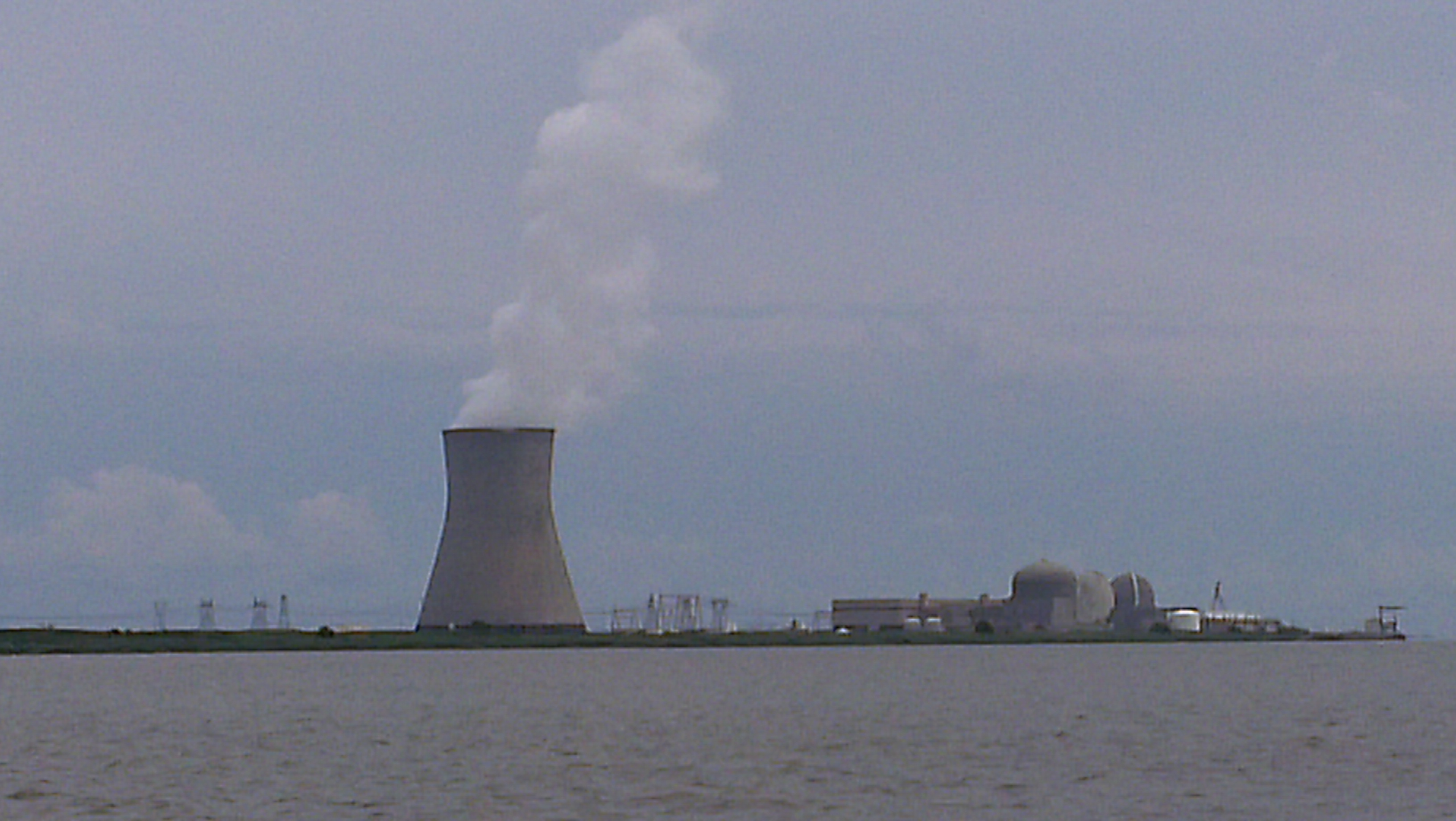
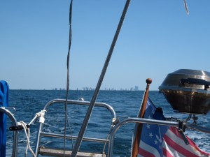
This nuclear power plant taunted us for hours as we slowly made it down the Delaware River against the current.
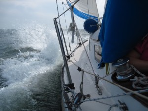
I once heard it said that the Delaware Bay is not cruised, but endured. Truth. The sailing was spirited. The mal de mer unwelcome. The weather forecast was East winds 5 to 10 knots. My anemometer is not working; but the good folks at Utsch’s Marina (our home for tonight) told us that the wind was around 30 knots and everyone was getting beat up. I suppose we feel better knowing that we weren’t alone.
Still, we sailed fast. We remained safe. And we are going to sleep real well tonight.
Tomorrow I’m going to try and get a diesel mechanic to help me locate the problem with the engine. Air is getting in somewhere. I’m sure, given time, I could find the culprit. But it is time to stop mucking with the beast and for us to get on with the trip. So far it’s been too much worry and work. Hopefully, sometime tomorrow we will depart for Martha’s Vineyard. It’s time to start enjoying the cruise.
Day 4 (July 21, 2014): Departing Cape May for Martha’s Vineyard
Adam's Spot
 Latitude:38.95114
 Longitude:-74.90576
 GPS location Date/Time:07/21/2014 13:42:43 EDT

 Message:departing for Martha's vineyard

 Click the link below to see where I am located.
 http://fms.ws/I8LmK/38.95114N/74.90576W

Departing Cape May, destination: Martha’s Vineyard (21 July 2014)
It was a pleasant, if short, visit at Utsch’s Marina in Cape May. I arranged a diesel mechanic for first thing in the morning to look at the engine. He went over the fuel system, tightened a few things a bit tighter than I had (after breaking a bleed screw I am somewhat paranoid about over tightening things), bled the system a few times, suggested I replace some old fuel lines, and gave the engine a clean bill of health.
I ran the engine for an hour after he left and it failed, right on schedule.
No matter. He was doing the same things I was, so I now feel a bit more confident in my diesel skills. I’ll keep working on it until I figure it out. But later. Today we leave for Martha’s Vineyard.
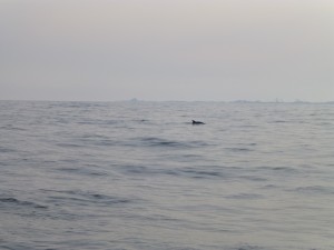
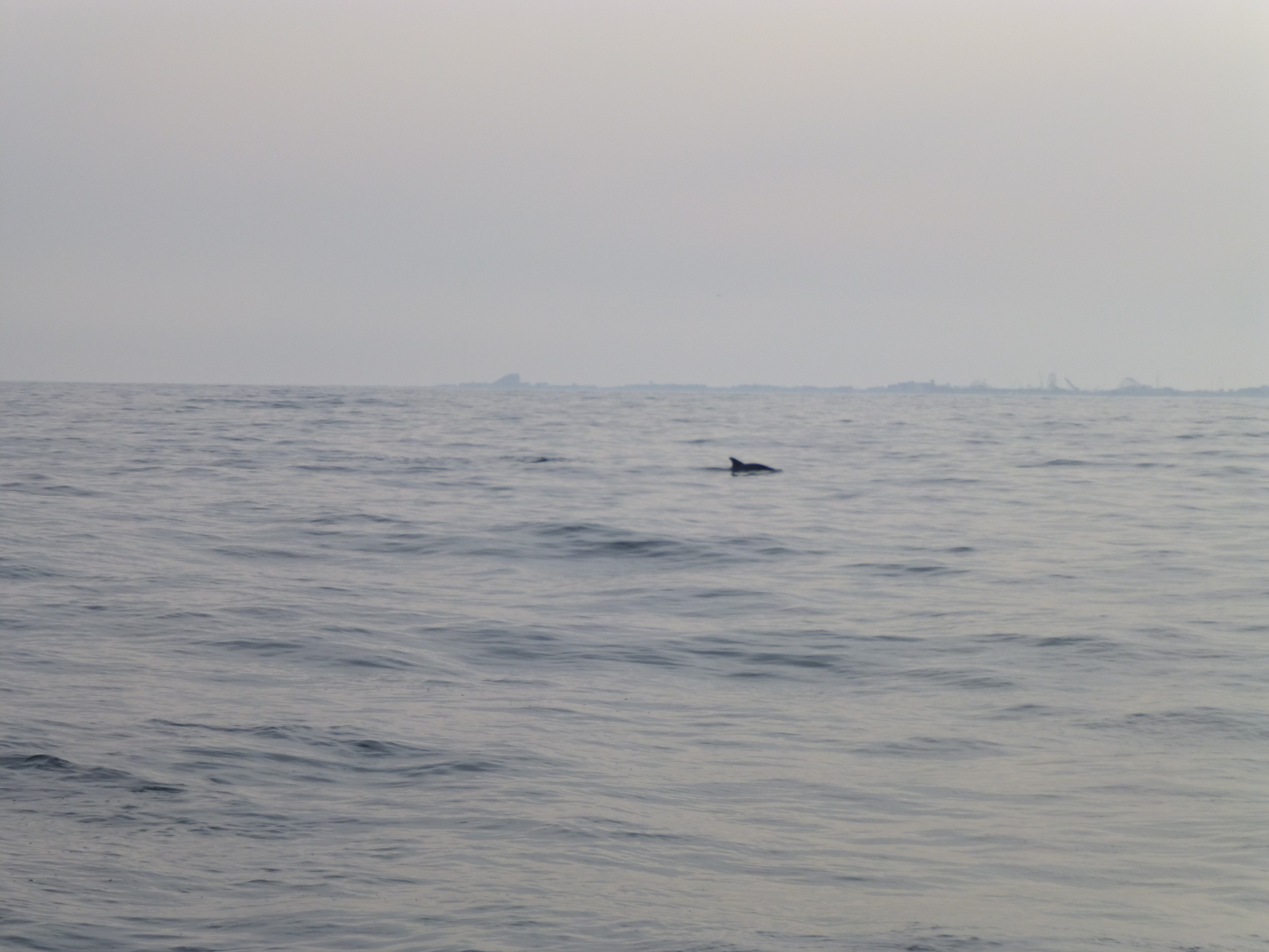
Our first day out we saw some dolphins! Sadly they didn’t want to stay around and play.
I think we entered the Atlantic right around 1430, and slowly started sailing in the light breeze. Early on we saw our first dolphin. Later on the wind got too light and the stupid, stinking, unreliable steel beast had to come back on. Conditions were comfortable, though. We saw more dolphins and had a lovely dinner. Lauren got her first experience as watch keeper. All in all, not a bad day in the open ocean. Certainly far more pleasant than Delaware Bay.
The overnight conditions continued to be calm, so we motored most of the night with the bright lights of Atlantic City in our lee. The good news is we can easily stay right on our rhumb line. The bad news is that we can’t motor all the way as we only have enough fuel to run the engine for 40 hours or so. Not that we’d want to. Day five promises some increasing wind later in the day.
Day 5 (July 22, 2014): Atlantic Ocean
Adam's Spot
 Latitude:39.66630
 Longitude:-73.46509
 GPS location Date/Time:07/22/2014 14:14:59 EDT

 Message:sailng w/spin. gd crs & spd. saw dlphn&whale.

 Click the link below to see where I am located.
 http://fms.ws/I9hUo/39.66630N/73.46509W
07:45 – I think we’ve crossed the worst of the shipping lanes. It’s getting quiet out here. We are outside of the site of land maybe 20 miles East of Little Egg Inlet. A little wind came in and we sailed for a couple hours. It didn’t last, though, and we are back to being a motor boat.
10:15 – Got some wind. Not a lot; but some. Raised the asymmetrical spinnaker (or genneker, or drifter…it’s a light air nylon sail). Gently sailing NE at a little north of 2 knots or so. The silence is welcome.
11:20, Heard a “whoosh” and saw a whale surface about thirty yards behind the boat. Whale surfaced three or four more times. Cool. I’m not sure (we only got to see him for a few seconds, and only the back); but I think it might have been an Orca (Killer Whale). He was probably around 20 feet long, as near as I can tell. Sadly, no photo.
14:00, Lunch of canned smoked ham, munster cheese and triskets. Still under asym making fourish knots. Sunny and comfortable with light seas and wind. 30 miles east of Barnegat Inlet.
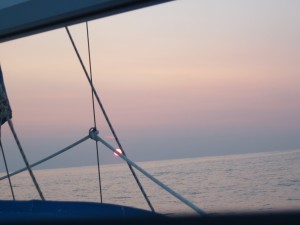
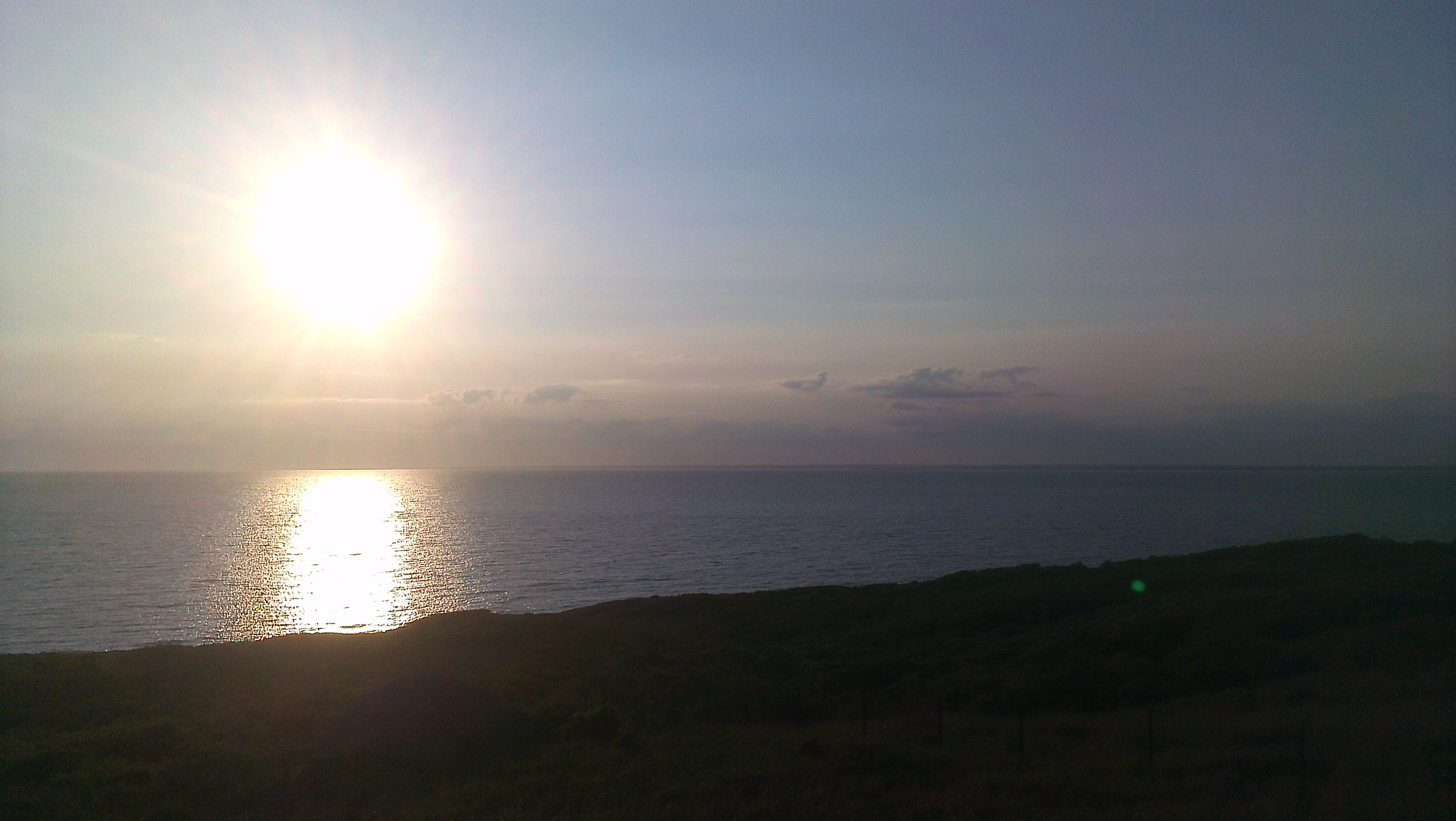
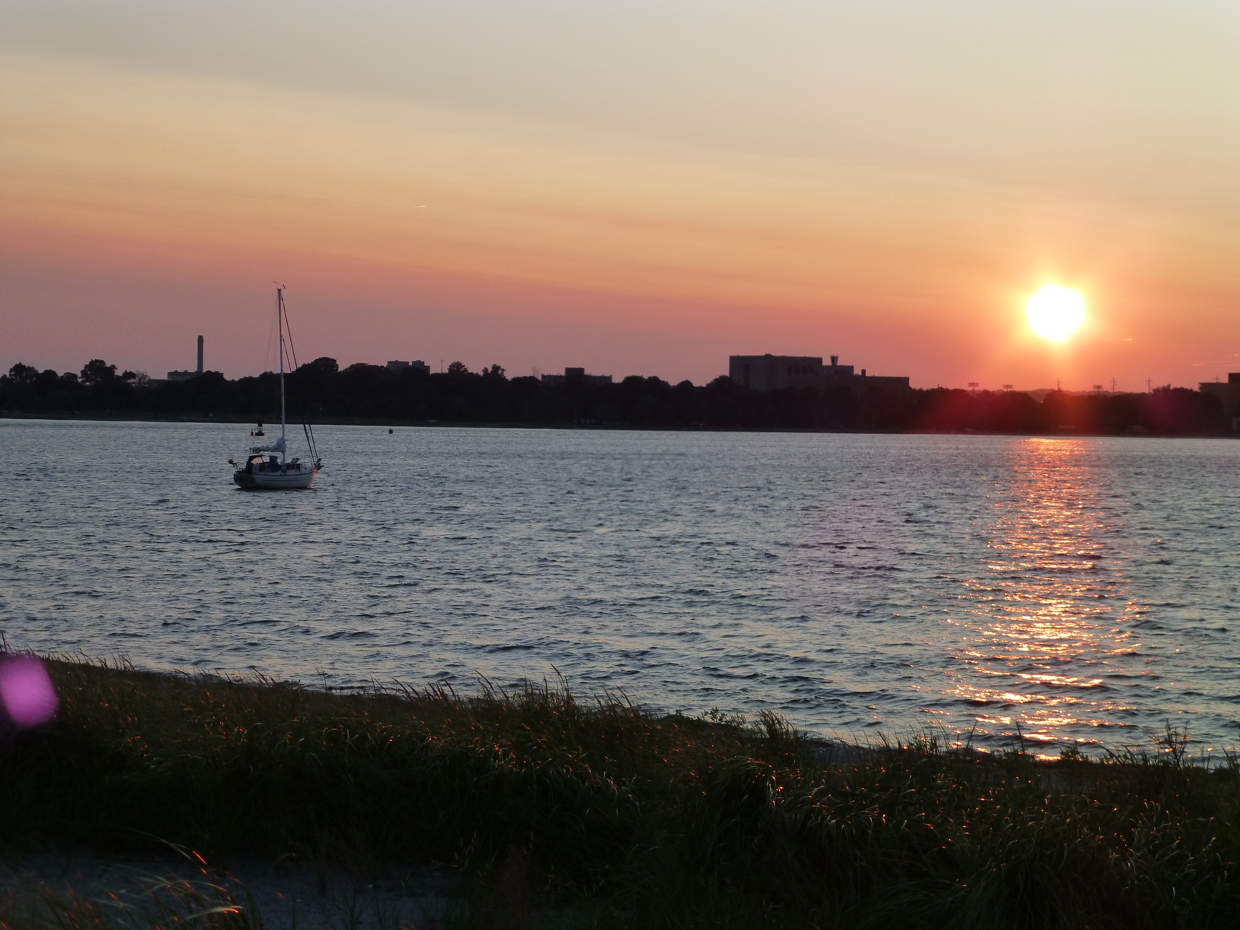
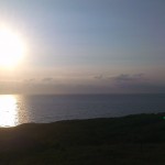
Sunrise, (22 July 2014)
18:00, Occasionally making seven knots under spinnaker. Too fast (above theoretical hull speed), and too hard to control, so we dropped it. Boat became more sedate. Dinner of Chicken a la king (from a can) and Chicken fried rice (Knorr Asian Side). We’re not generally into the processed food thing; but this hit the spot.
19:17. What a glorious day of sailing! The boat is rigged for the evening, with no headsails and a full main going nearly directly downwind and darn close to our rhumb line. If the forecast holds we should be able to sail all night, leaving the noise of motoring to another day. We are, so far, making better time than I estimated. If the forecast holds we can expect more of the same. Lauren is taking a pre-watch nap. Last night worked out to five hour watches. Long for some. For us it worked. At least once.
20:00, We are about 47 miles from the nearest land. This is as far as we are likely to be offshore, and will rapidly start closing the distance over the next day. So far the offshore portion of this trip has been a (rolly) dream of great weather.
Day 6 (July 23, 2014): Atlantic Ocean, 30 miles off of Long Island
Adam's Spot
 Latitude:40.45871
 Longitude:-71.89957
 GPS location Date/Time:07/23/2014 11:59:40 EDT

 Message:shld mk mv tmrw. prob tashmoo or VnHvn.

 Click the link below to see where I am located.
 http://fms.ws/IAtMO/40.45871N/71.89957W
Adam's Spot
 Latitude:40.91272
 Longitude:-71.09302
 GPS location Date/Time:07/23/2014 22:08:08 EDT

 Message:last nt@sea. prob arrive edgartown afternoon.

 Click the link below to see where I am located.
 http://fms.ws/IBZ-H/40.91272N/71.09302W
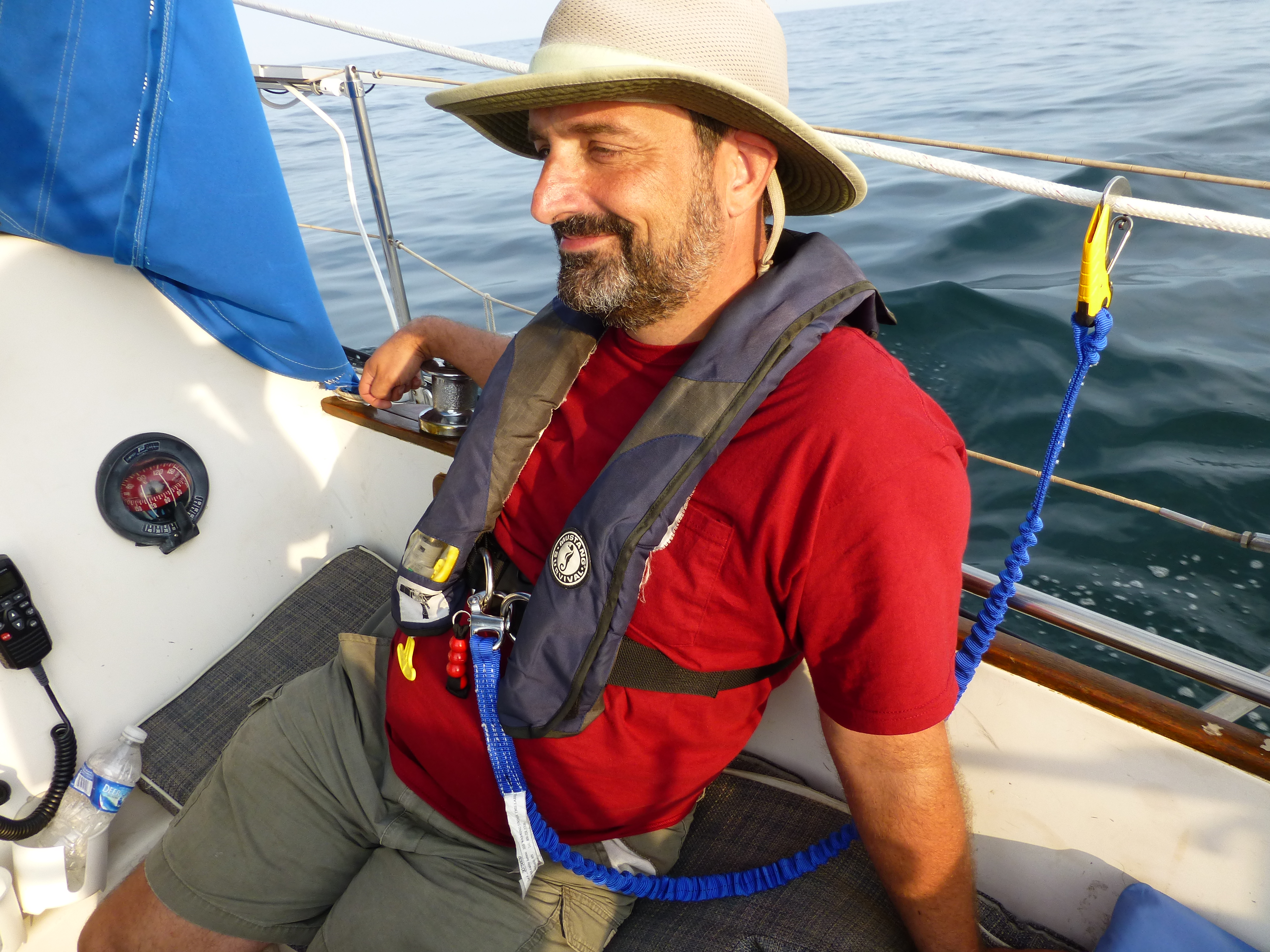
08:45 – Still sailing along under main alone above four knots making straight down the rhumb line. Lauren still sleeps from her night watch. I’m drinking cold coffee. Currently we are about to cross the outbound traffic lane from New York. Happily, there currently isn’t much traffic.
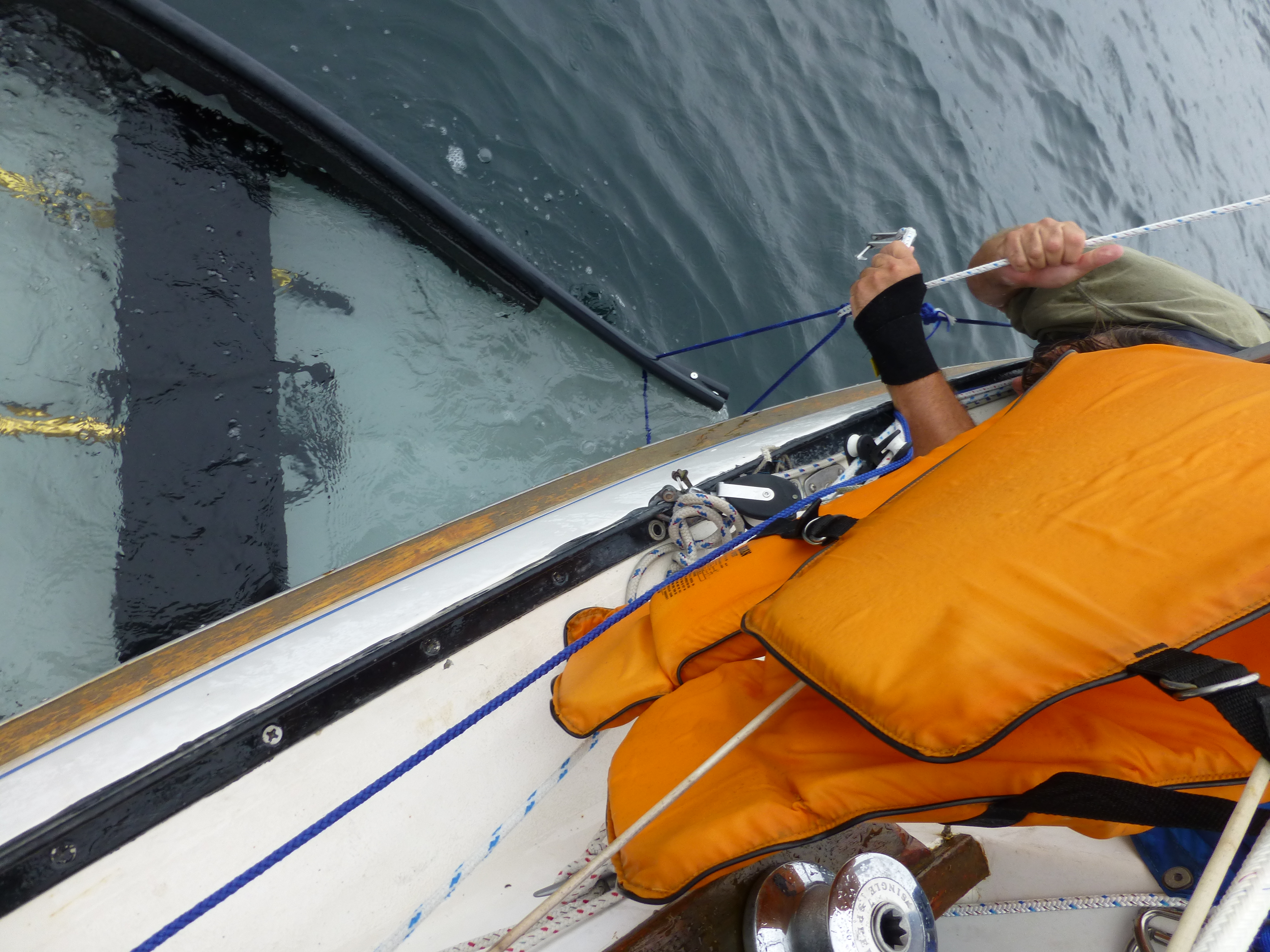
Last night was different, though, as we ended up playing cat and mouse with a fishing boat. The AIS suggested we were on a collision course so we adjusted course as we could (I didn’t want to jibe as a preventer was rigged…given the dark and bumpy night I didn’t want to unrig and rerig on the other side in the pitch black if avoidable). The fishing boat, however, was driving some sort of miles wide race course track, and no matter what we did it seemed that we would always be in contention for the same bit of ocean. The fishing boat also just would not answer the VHF, even when using the DSC “call” feature. I’m pretty sure they were aware of us, though, as they neatly circled us as we passed. Had a little less fun with another fishing boat and a freighter. Neither of them would talk on the VHF either. The freighter did light up all his deck lights as we got close, though. I’m guessing that that was his way of saying “here we are!” and the other fishing boat moved out of our path. Comforting to see they were aware. Less comforting that they refused to talk.
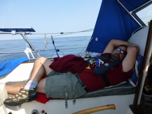
Adam sleeping in the cockpit while Lauren had the watch
I believe we will be at anchor around lunch tomorrow. The anchorage is uncertain at this point; but I’m guessing either Vinyard Haven or Lake Tashmoo. We’ll see what tide and mood does for us.
14:30 – Shark sighting by Lauren. Adam was napping.
18:00 – NOAA weather suggests there might be t-storms tonight. Hope not.
19:47 – I think we are probably going to head to Edgartown instead of one of the Vineyard Haven ports.
Day 7 (July 24, 2014): Edgartown & Lake Tashmoo
It was a long night. With the thunderstorms being predicted we rigged the boat for rough weather. Happily nothing came of it. I did end up staying up pretty much the whole night, though, as we worked our way in to Martha’s Vineyard.
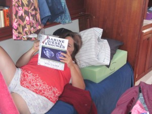
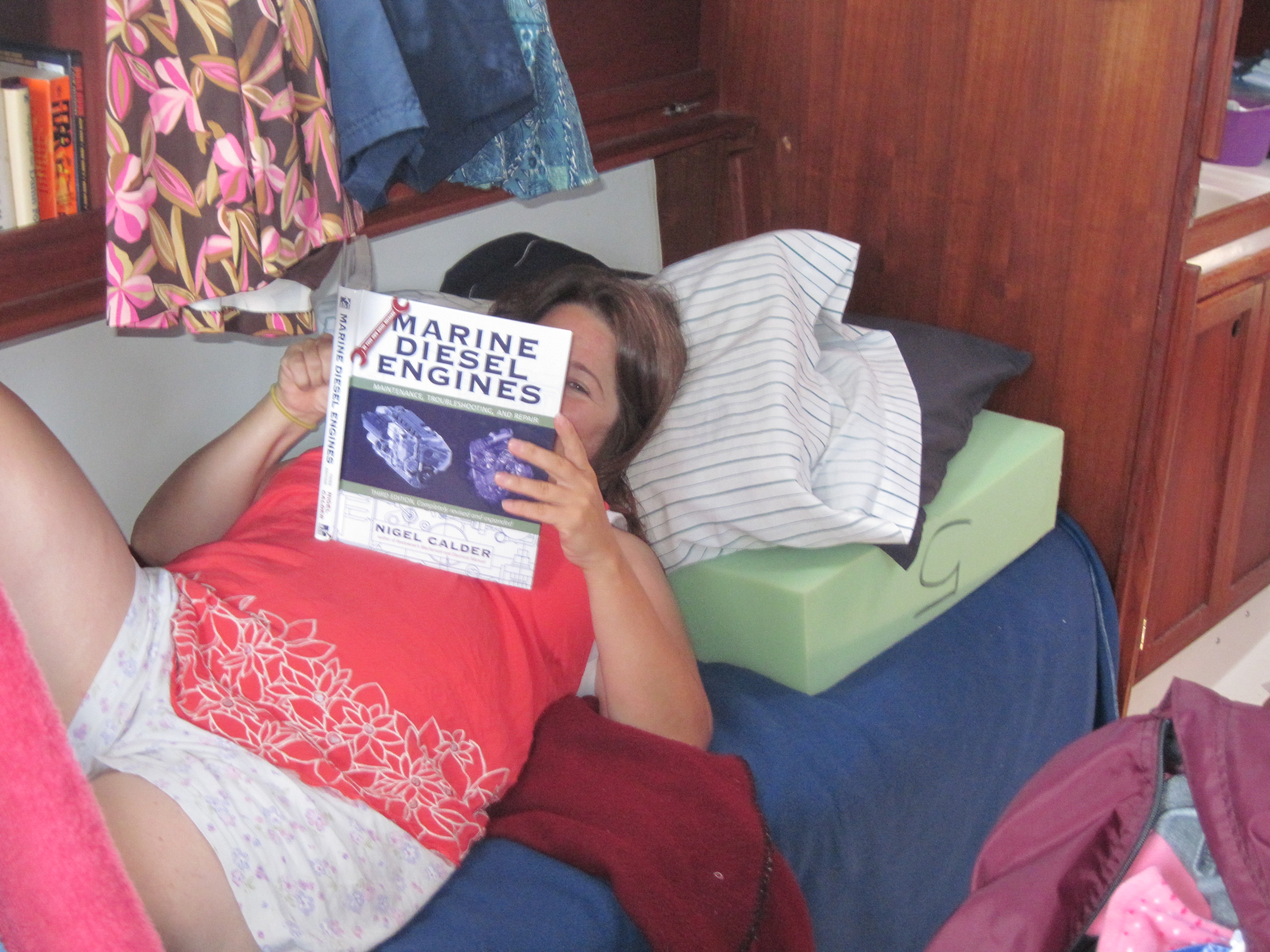
With all the engine problems we’ve been having, Lauren decided to read up a bit…
We came into Edgartown. With the wind the outer harbor didn’t look inviting, so we poked inside for a tour. Mooring balls were expensive, and it was unclear if the anchorage (deep inside the harbor) was even open, so we returned to the outer harbor and anchored. It sucked. Strong winds and significant waves made it very uncomfortable. After some discussion we raised anchor bound for Lake Tashmoo. The engine was temperamental, as always; but there was a lot of wind so we sailed. It would have been fun sailing if I wasn’t so damned tired. We made it into quiet Lake Tashmoo and slept for better than 12 hours.
Day 8 (July 25, 2014): Oak Bluffs
Adam's Spot
 Latitude:41.45840
 Longitude:-70.56041
 GPS location Date/Time:07/25/2014 10:38:57 EDT

 Message:oak bluffs...

 Click the link below to see where I am located.
 http://fms.ws/IDPpM/41.45840N/70.56041W

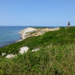
Entering Oak Bluffs Harbor, Martha’s Vineyard
We left Lake Tashmoo, under power (sigh), and made our way towards Oak Bluffs Harbor to meet up with good friends Brian and Lisa. We got a somewhat late start and managed to arrive at the exact same time as the fast ferry holding Brian and Lisa, allowing a nice photo in the entrance. Too bad the sails were down.
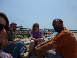
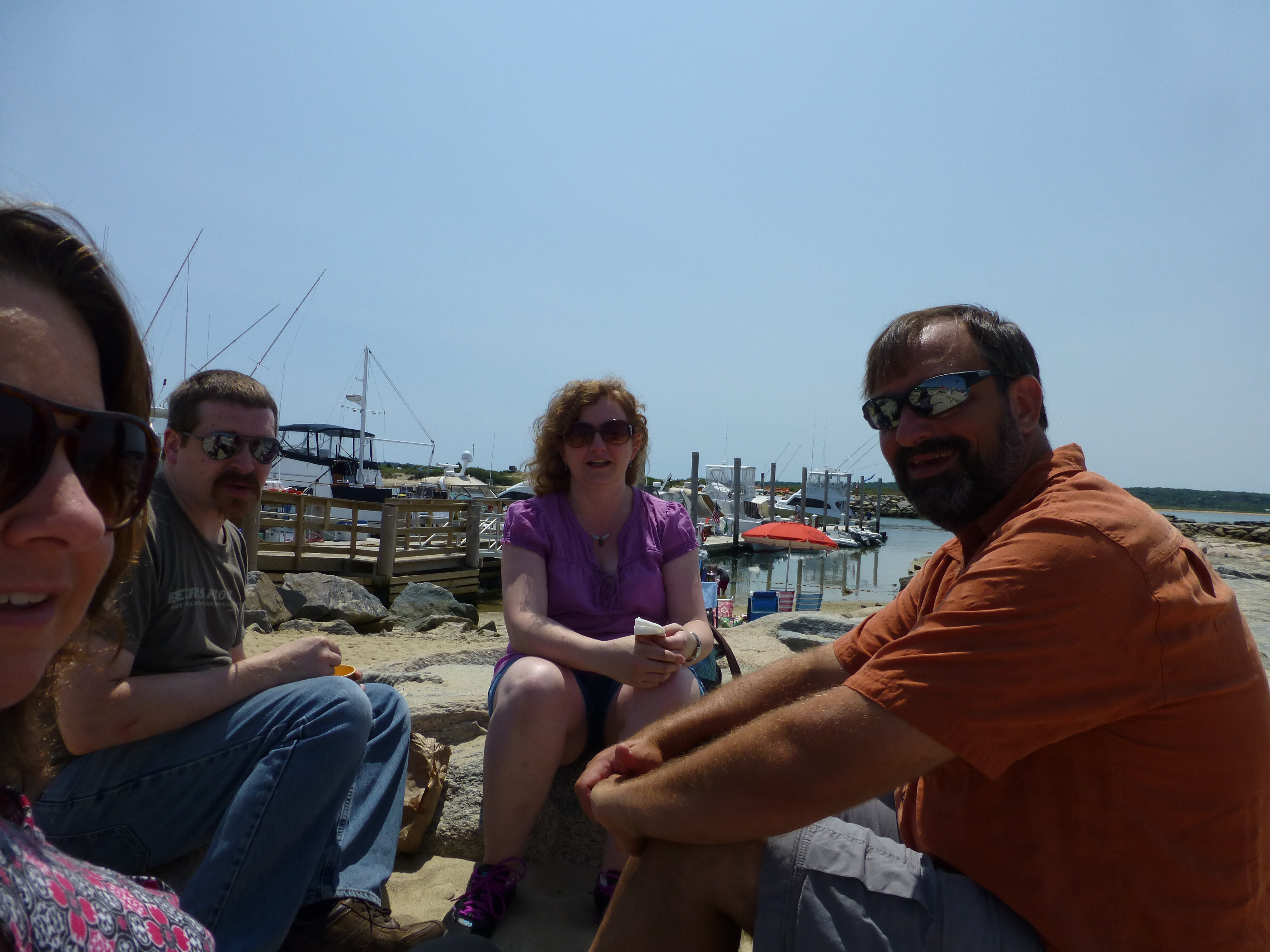
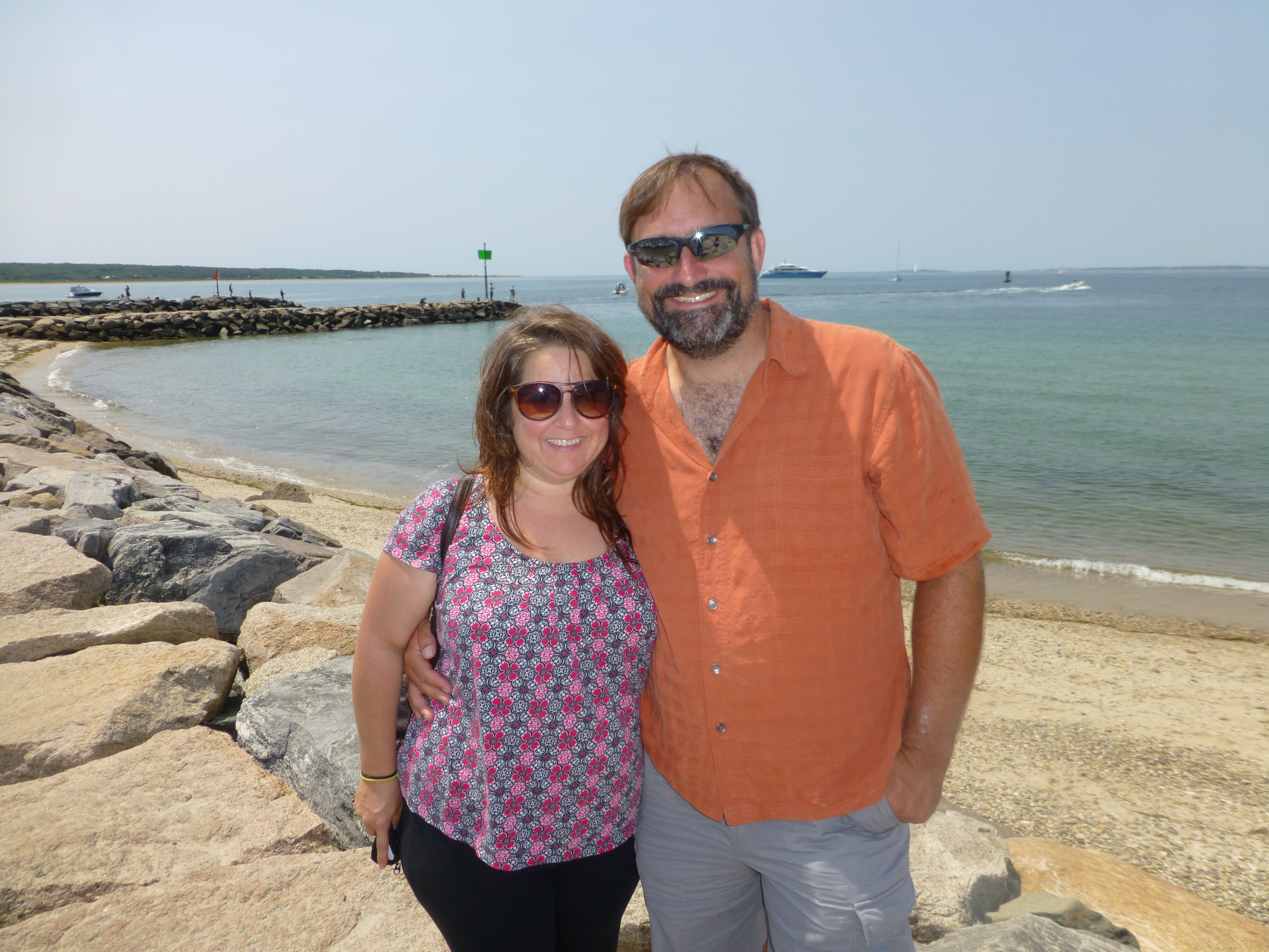
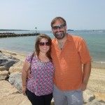
Adam, Lauren, Brian and Lisa at Menemsha on Martha’s Vineyard
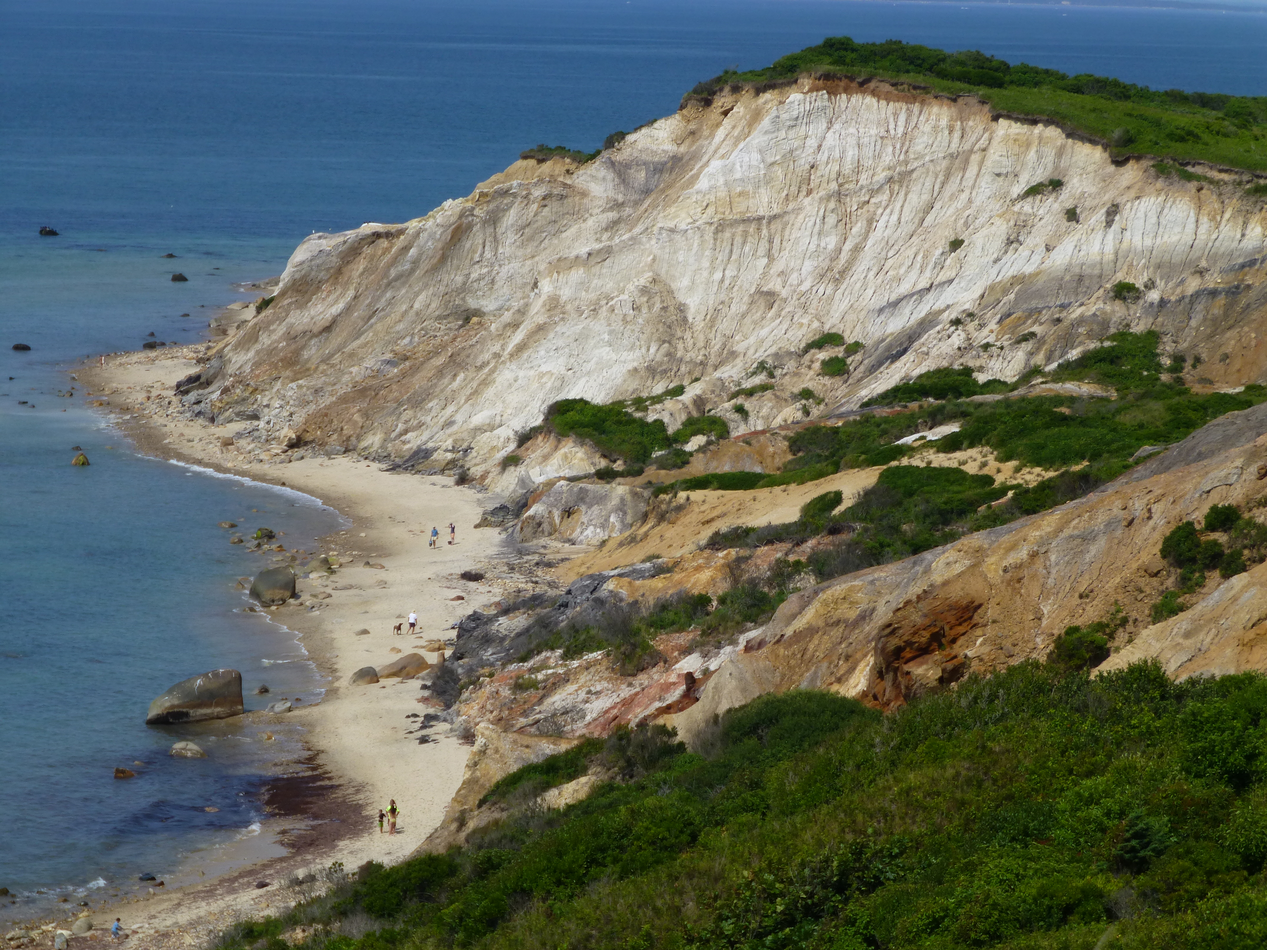
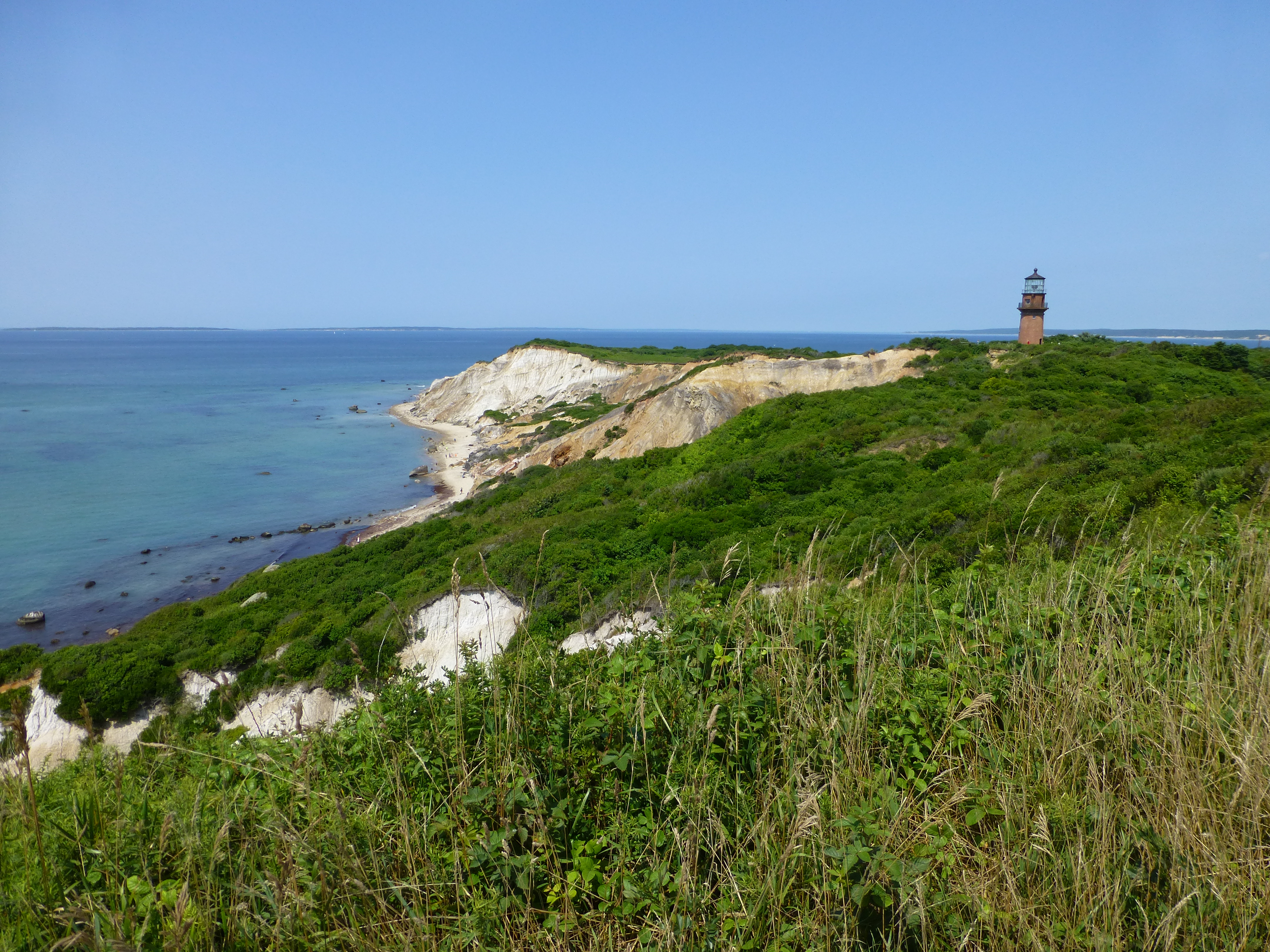
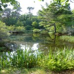
We grabbed showers and rented a jeep and the four of us toured the island. We went to Aquinnah, Mytoi Japanese Gardens, and the fishing village Menemsha with great clam chowder. The day was too short and we sadly had to watch Brian and Lisa depart on the last ferry.
Lauren and I grabbed dinner at Sharky’s, walked around the Ginger Bread Houses, and returned to the boat and crashed.
Day 9 (July 26, 2014): Vineyard Haven
Adam's Spot
 Latitude:41.45684
 Longitude:-70.58344
 GPS location Date/Time:07/26/2014 11:18:03 EDT

 Message:vineyard haven for motor repair and rest.

 Click the link below to see where I am located.
 http://fms.ws/IElWn/41.45684N/70.58344W
Sailed from Oak Bluffs to Vineyard Haven, where there is a West Marine and a Yanmar Dealer.
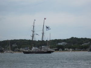
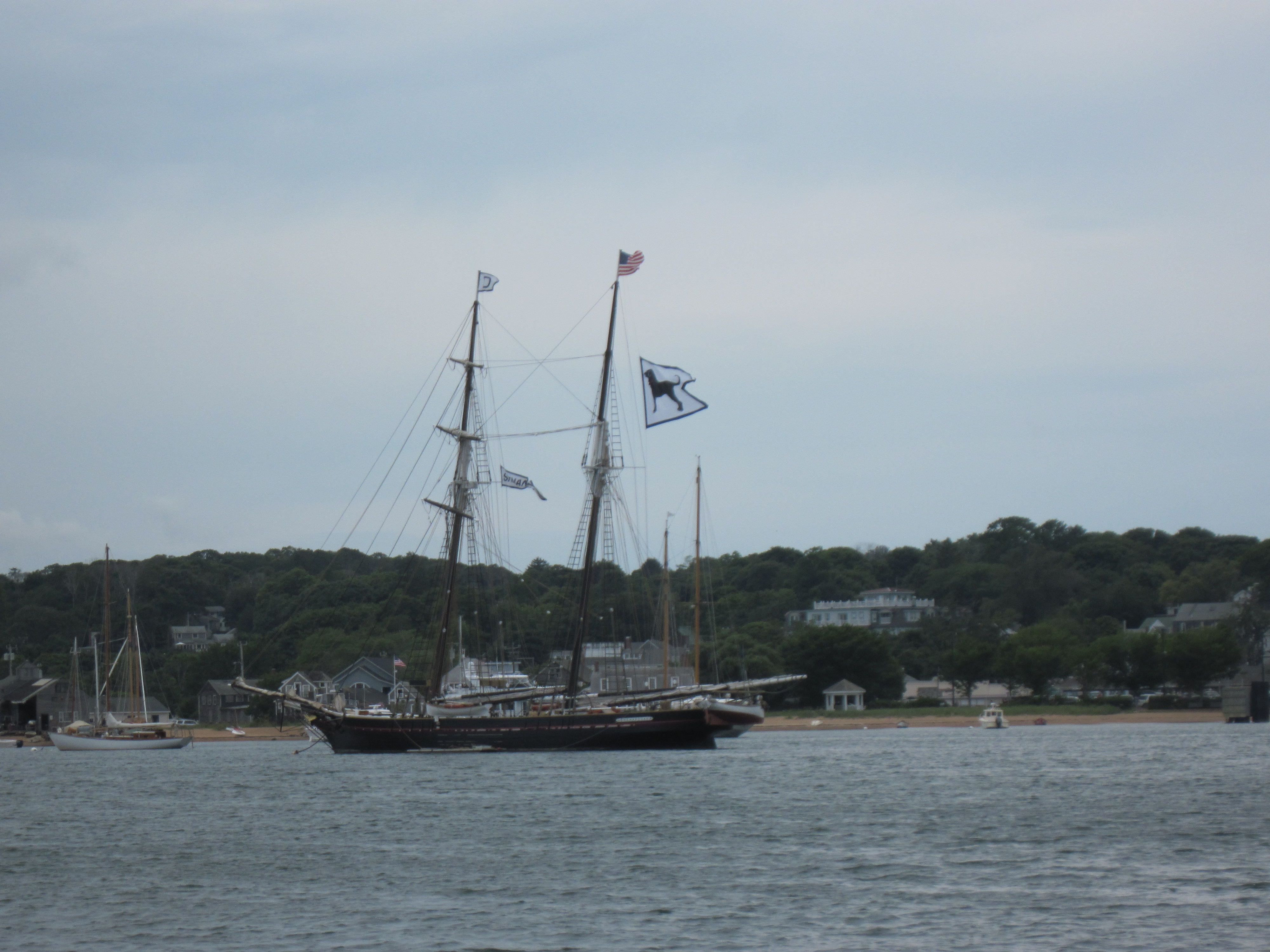
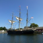
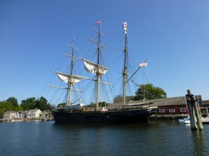
Black Dog tallship Shenandoah
We arrived in the harbor and went under the draw bridge into the lagoon pond. This was a mistake with the strong southerlies, and it was uncomfortable. The bridge was going to be closed for several hours, so I went for a swim and we assembled and launched the dinghy. This was much more difficult with the very gusty wind and it took us quite awhile. When the bridge next had an opening at 1530 we took off back into Vineyard Haven Harbor and dropped anchor which was much more comfortable with more interesting boats to look at.
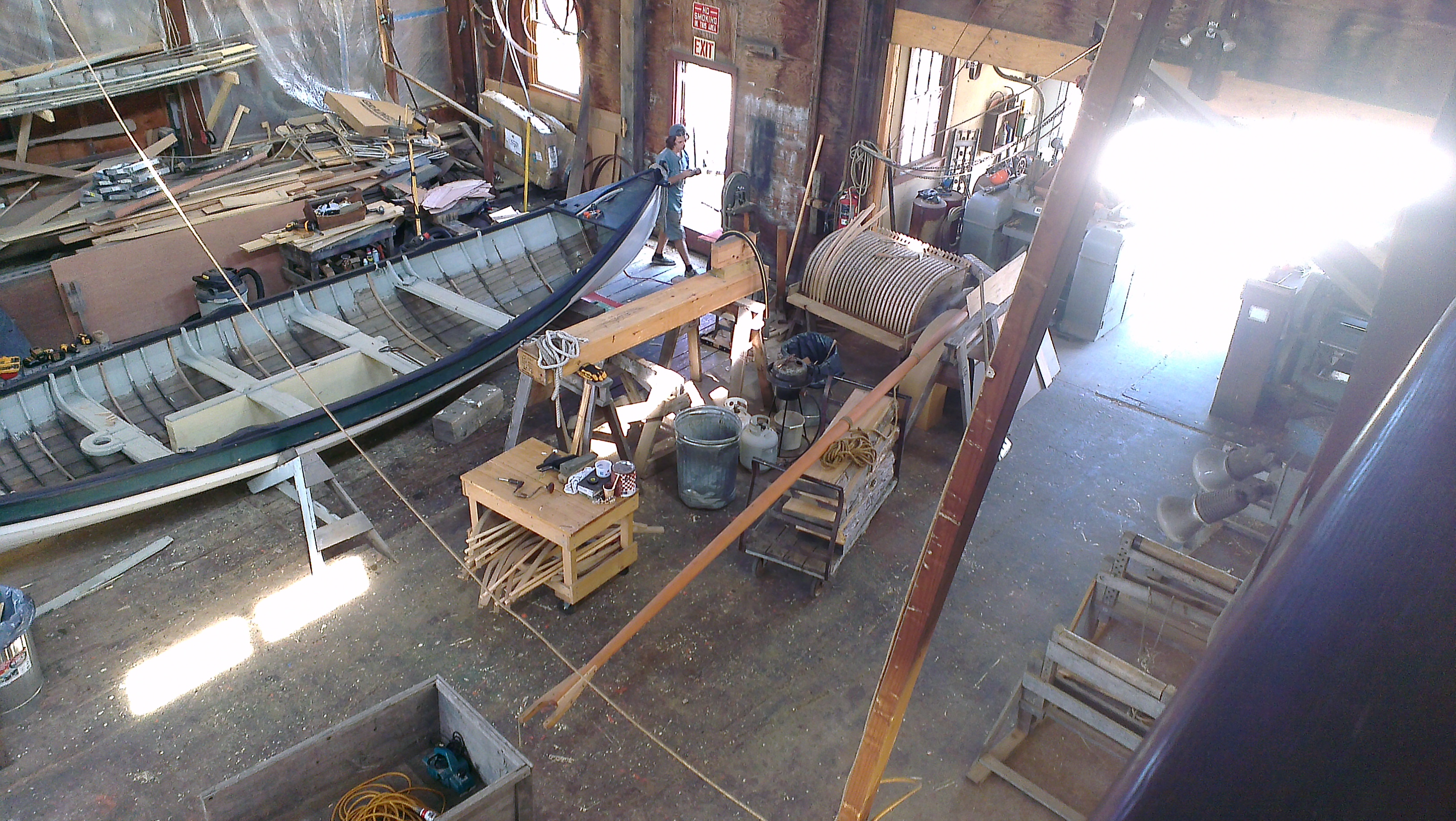
I dinghied into town and found the West Marine was just a little “Express” store with little in the way of engine parts. The Yanmar dealer (Martha’s Vineyard Shipyard) closed at noon, and wouldn’t open again until Monday. I guess we are staying for a bit.
Day 10 (July 27, 2014): Vineyard Haven
Taking a quiet day. Some swimming and reading. Yanmar dealer opens tomorrow.
Day 11 (July 28, 2014): Vineyard Haven
The Yanmar dealer is open! Lauren and I packed up shower bags, and took a long row to the Harbor Master’s dock. It was an on and off rainy day; and wouldn’t you know it the skies opened up when we were halfway across the harbor.
We showered (free showers!), and I walked to the Yanmar dealer for the parts I needed. We then spent a few hours walking about, grabbing food, and doing the tourist thing. We really wanted a beer; but it is a dry town. Darn.
After getting back to the boat I replaced the suspect parts (crush washers and gaskets). I ran the engine, and an hour later it stopped.
We are planning on Cuttyhunk tomorrow. I think.
Day 12 (July 29, 2014): Cuttyhunk
Adam's Spot
 Latitude:41.46579
 Longitude:-70.59023
 GPS location Date/Time:07/29/2014 11:14:48 EDT

 Message:leaving Martha's vineyard to Cuttyhunk.

 Click the link below to see where I am located.
 http://fms.ws/IITi2/41.46579N/70.59023W
Adam's Spot
 Latitude:41.42682
 Longitude:-70.92449
 GPS location Date/Time:07/29/2014 16:26:03 EDT

 Message:engine prob fixed! arrived cuttyhunk.

 Click the link below to see where I am located.
 http://fms.ws/IIrDK/41.42682N/70.92449W
After yesterday’s failed adventure with the engine, I got drunk. It seemed like the thing to do. This morning I looked at the problem with fresh eyes. The fuel line coming from the Racor to the Fuel Lift Pump (through a priming bulb) looked fine. But there was this funny little device strapped to it called a Fuelmaster. I pulled that off and the fuel line below it was all cracked and unhappy looking. Ah, ha! Replaced the fuel line, and squeezed the primer bulb which is now much firmer than it was. I think this might be it!
Cuttyhunk (29 July 2014)
Left Vineyard Haven for Cuttyhunk. Motored the whole way in light winds against a heavy current in Vineyard Sound. The engine work perfectly for the entire trip…
…until we tried to enter the Cuttyhunk canal. We had slowed way down as there were a bunch of kids in Optimist Dinghies making their way back into the pond. For some reason the engine died. We got it started up fairly quickly, but then it died again and we washed ashore on a falling tide. Happily some good Samaritans helped tow us into the Pond and got us safely tied up. It took a very few minutes to get the motor running. I noticed that the engine cut off wasn’t fully released and assume this was the problem. Once the engine was running we moved into an area behind the mooring field where we could drop anchor and rowed into town.
Cuttyhunk Sunset (29 July 2014)
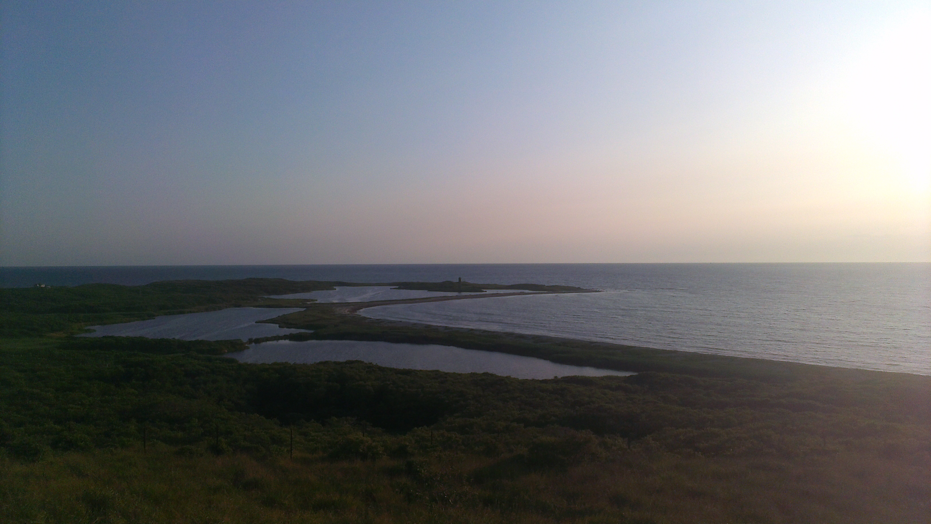
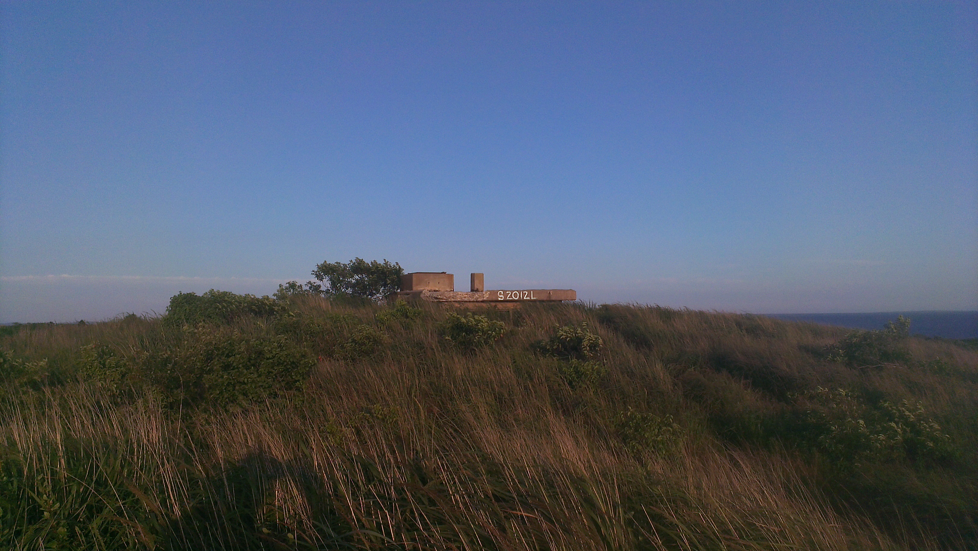
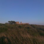
Cute town. We ate dinner at a little shack on the dock run by a charter fisherman (I think) when he wasn’t out fishing. Good Chowder, stuffed scallops and Tuna sandwich. Good food in general. Interesting and quirky locals. We then hiked to a lookout point on top of an old WWII spotting bunker for a great view. Some further exploration found several other abandoned bunkers in the area. It’s a small place and it didn’t take long to look around. Next time I hope to spend several days here. NOTE: Ice is expensive and beer is unavailable. Plan accordingly!
Day 13 (July 30, 2014): Appanoag Harbor, Warwick, RI (Brian’s Marina)
We left Cuttyhunk for a long motor to my friend Brian’s marina. He was going to help us with new batteries before I discovered a bolt holding the battery cable to the terminal was loose. We still wanted to visit (we hadn’t gotten enough of good friends), so set out under power in very light winds.
Eventually the wind built up and we were able to sail up Narragansett Bay to Appanoag Harbor. Life really is much better under sail. We saw Brian on his boat Bella Lisa just outside of Greenwich Cove, and followed him in.
Dinner with Brian, Lisa and Ern at an excellent Mexican Restaurant, and cigars with the boys before heading to bed.
Day 14 (July 31, 2014): Bristol, RI & Potter’s Cove
Adam's Spot
 Latitude:41.64351
 Longitude:-71.33823
 GPS location Date/Time:07/31/2014 21:16:51 EDT

 Message:1st Bristol, now potter's cove. windy day.

 Click the link below to see where I am located.
 http://fms.ws/ILo1F/41.64351N/71.33823W
Departed Brian’s marina enroute to Bristol Harbor to meet Mom. The weather forecast 5 knot southerlies. Reality was probably closer to 25 knots. It was good, exciting sailing. Started the motor when in the area of the anchorage; but with the wind it was too far to row to a dinghy dock (seriously considering getting an outboard!), so continued into the mooring field when the engine died (ugh!) leading to all sorts of drama as we tried to avoid other boats and pick up a mooring after re-raising sail in two to three foot seas and very breezy conditions. It was ugly and difficult. Eventually we just dropped an anchor right in the middle of the field and affected engine repairs. Even after the engine was running, picking up a mooring proved very difficult and took many tries. I felt bad for Mom who spent hours waiting for us; but we rested and dealt with anxiety for awhile before attempting to go ashore.
Lauren needed a break, so I rowed ashore solo. With the wind and waves it was a workout; but I made it safely and met Mom for a bite of lunch, some shopping and ice cream. The row back to Seeker was almost as bad; but at least the wind was at my back.
The anchorage was just not comfortable, so we dropped the mooring and had a beautiful sail to a well protected Potter’s Cove. We dropped anchor a half hour after sunset and had a peaceful night.
Day 15 (August 1, 2014): Newport, RI
Adam's Spot
 Latitude:41.48645
 Longitude:-71.32623
 GPS location Date/Time:08/01/2014 13:47:48 EDT

 Message:Newport, RI. wx may keep us here a cpl days.

 Click the link below to see where I am located.
 http://fms.ws/IMbRg/41.48645N/71.32623W
Still trying to find why the engine stalls. Sometimes the fuel filter bowl fills with air suggesting another leak (although things are much better than they were, and the engine appears to work fine at high RPMs). I tightened the drain plug on the Racor primary filter water separator bowl after Lauren saw a bubble of air in the area, and broke the housing. We affected emergency repairs using Superglue. It appears to be working.
We sailed from Potter’s Cove to Newport and picked up city mooring #11 right next to Goat Island. The fuel filter repair held perfectly. This is the best the motor has run all trip. We attempted to get a replacement housing but could not source one locally. We are hoping it holds. If not we purchased the fitting necessary to bypass the primary filter. Not ideal; but it is better to keep the motor running.
We went ashore via water taxi for several hours, eating at Red Parrot, coffee at some little shop on Thames with a bank vault door inside, and drinks at Buskers. We went looking for a stop and shop but Google Maps failed us.
Day 16 (August 2, 2014): Newport, RI
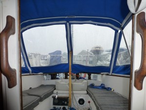
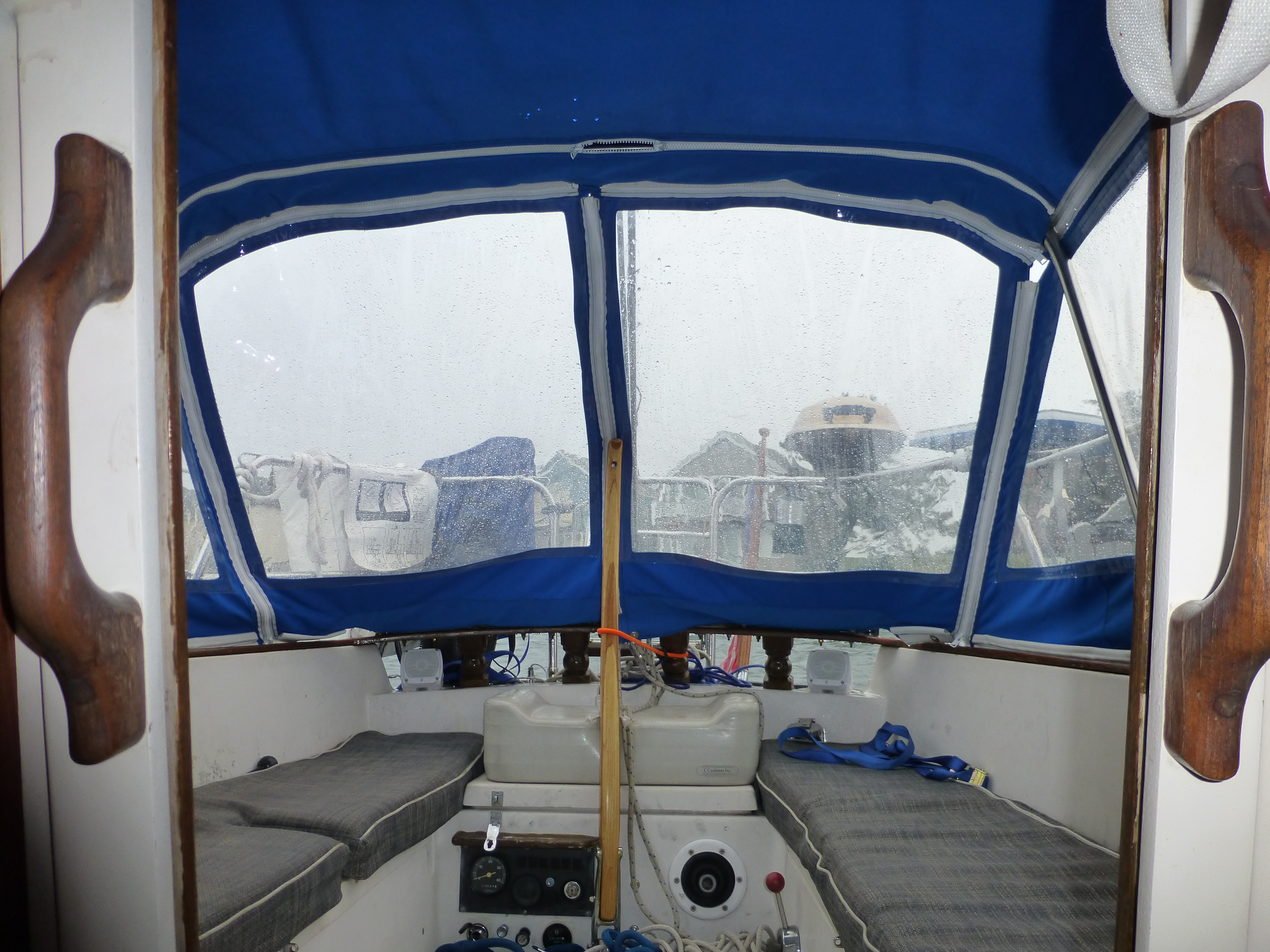
It was a rainy day in Newport. We put up the cockpit enclosure, and just hunkered down and rested.
Rainy day chilling on the boat on the mooring. Happy to break into the Growler of beer that Brian left us.
Day 17 (August 3, 2014): Block Island, RI
Adam's Spot
 Latitude:41.19032
 Longitude:-71.57562
 GPS location Date/Time:08/03/2014 16:04:16 EDT

 Message:drama=stories. Seeker=drama. Block Island.

 Click the link below to see where I am located.
 http://fms.ws/IPD63/41.19032N/71.57562W
Departed Newport around 0900, I guess. There was a huge parade of boats circling the harbor before heading off to points unknown. We waited for them to pass. And waited. And waited. And finally could wait no longer so snuck out beside them.
Swamped Porta-Bote
The Atlantic had an uncomfortable roll to it. Not too bad when the wind blew enough for us to sail. When still, it was truly unpleasant and made both of us a little ill.
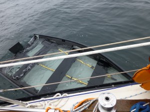
Just about as far from land as we were going to be this trip, Lauren looked back and remarked that our dinghy (Porta-bote) that we are currently towing had water periodically entering it from wave action and it was getting very low in the water. We hove to, pulled it to Seeker, and bailed as best we could given the conditions. A close pass by the Block Island Fast Ferry nearly swamped it again. We suspect the problem may have originated as a result of not bailing out the Newport rain water.
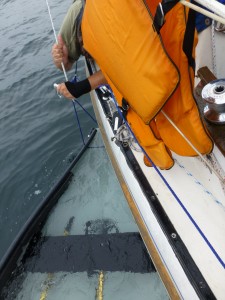
I tied the main halyard on to the Porta-Bote’s painter and hoisted the boat vertically into the air. This managed to get most of the water out and let us continue our trip.
A half hour or so after resuming our trip to Block Island, another wave swamped the dinghy and seconds later it went down. There is positive floatation in the dinghy, so it sort of floated just barely at the surface of the water. This clearly is a problem. We took the main halyard and tied it to the painter and hoisted the bow of the dinghy way up in the air, emptying most of the water and allowing the boat to float properly again. For most of the rest of the trip I kept the dinghy tied to the halyard, bow high. We had no further trouble. When the seas settled a bit very close to Block Island I lowered it back down, and let it tow properly on the painter a boat length or so back.
We found a nice spot to anchor near Breezy Point in the Great Salt Pond. I climbed in the dinghy to finish the bailing and found it quite unstable. I’m mostly sure this is a major contributing cause to our trouble. A lesson learned. Losses include a PFD and a bailing bucket.
I was surprisingly tired after the ordeal, and was probable asleep by 18:30. I got a long sleep.
Day 18 (August 4, 2014): Block Island, RI
Rowed to Mosquito Beach, and walked the short distance to the very crowded beach on the ocean side. Swam a bit. The wind picked up so we laboriously rowed back to the boat. 2/3 of the way a good Samaritan took pity and towed us the remaining distance. I think I’m going to have to get an outboard, or resolve myself to being stuck when the wind unexpectedly picks up.
We took the Old Harbor Launch in the evening to get dinner at The Oar. Surprisingly reasonable prices, and decent food and beer.
We never did make it into town. We need to do some re-provisioning; but aren’t yet desperate. Nothing cold remains; which saves us money on ice, I guess. I fear the water tanks might be getting low. We have plenty of bottled water so it shouldn’t be too much of a problem.
There is a boat that goes around selling water and ice. $6 for a five pound bag of cubes, or $8 for a ten pound block, and water at $.50 a gallon. I almost bought water; but there is a $20 minimum. My tank only holds 20 gallons! Even if empty that would be $1/gallon for me. If I’m half empty it would be $2/gallon. Way too much. I really should check the tank levels; but it requires taking apart the main bunk which is a pain to remake up, so I usually just guess. So far we haven’t run out yet. Knock on wood.
Tomorrow we head out early for Mystic Seaport. We are hoping to get a slip in the marina there. Expensive; but it includes free admission to the Seaport, including after hours access. It will also give us a chance to re-provision, do laundry, and basically take care of some things.
Day 19 (August 5, 2014): Mystic Seaport
 Adam's Spot
 Latitude:41.19041
 Longitude:-71.57507
 GPS location Date/Time:08/05/2014 10:04:31 EDT

 Message:rdy to depart Block Island, but fogged in.

 Click the link below to see where I am located.
 http://fms.ws/IRFEd/41.19041N/71.57507W
Adam's Spot
 Latitude:41.36356
 Longitude:-71.96475
 GPS location Date/Time:08/05/2014 20:33:26 EDT

 Message:docked at Mystic Seaport for the evening.

 Click the link below to see where I am located.
 http://fms.ws/IR-vB/41.36356N/71.96475W
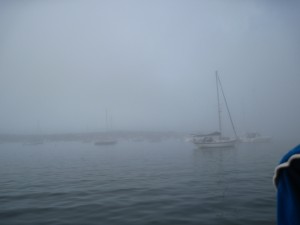
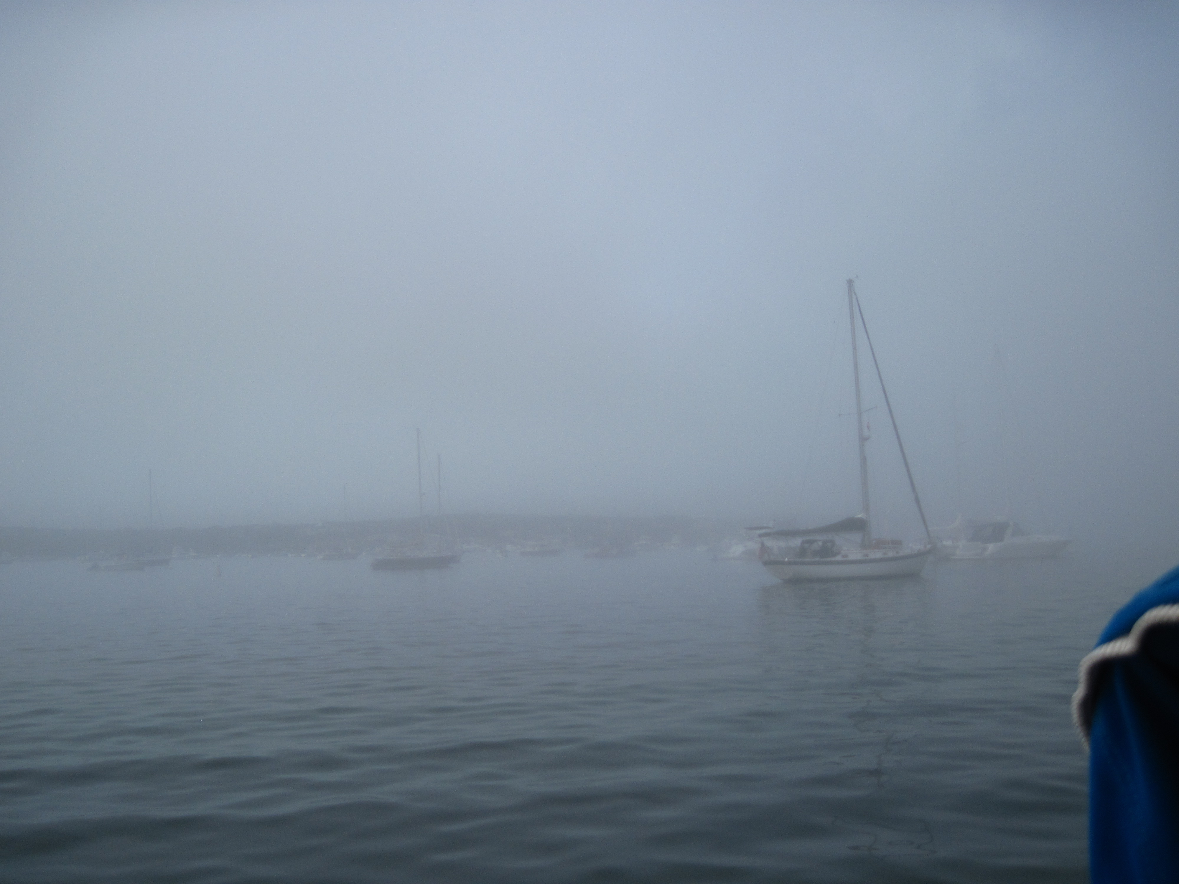
Block Island fogged in
We spent the morning at anchor, socked in with fog. This is definitely messing with my plans on being at Mystic Seaport at a reasonable hour. Sometime around 1100 the fog burned off at the island showing a beautiful day, so away we went. Just outside the harbor, however, the fog was still thick, and remained that way for hours.
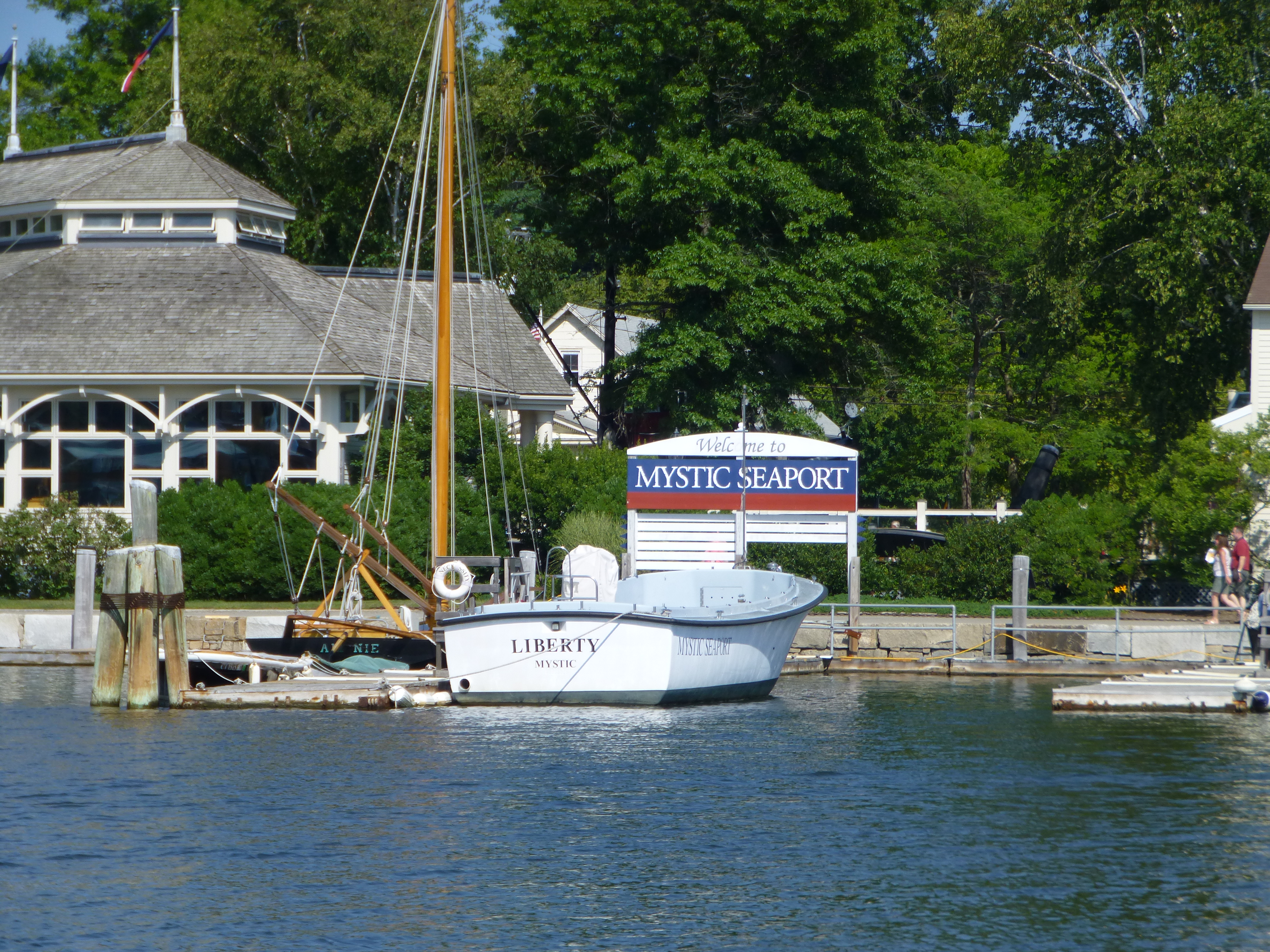
Eventually the skies brightened and we found ourselves at Mystic Seaport, although hours later than planned. The plan all along was to stay at the marina, and we discussed at length whether or not we should today, or tomorrow. In the end, the calendar made up our mind and we called in for a berth. We had no reservations; but there was plenty of space.
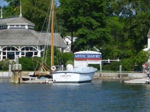
Welcome to Mystic Seaport
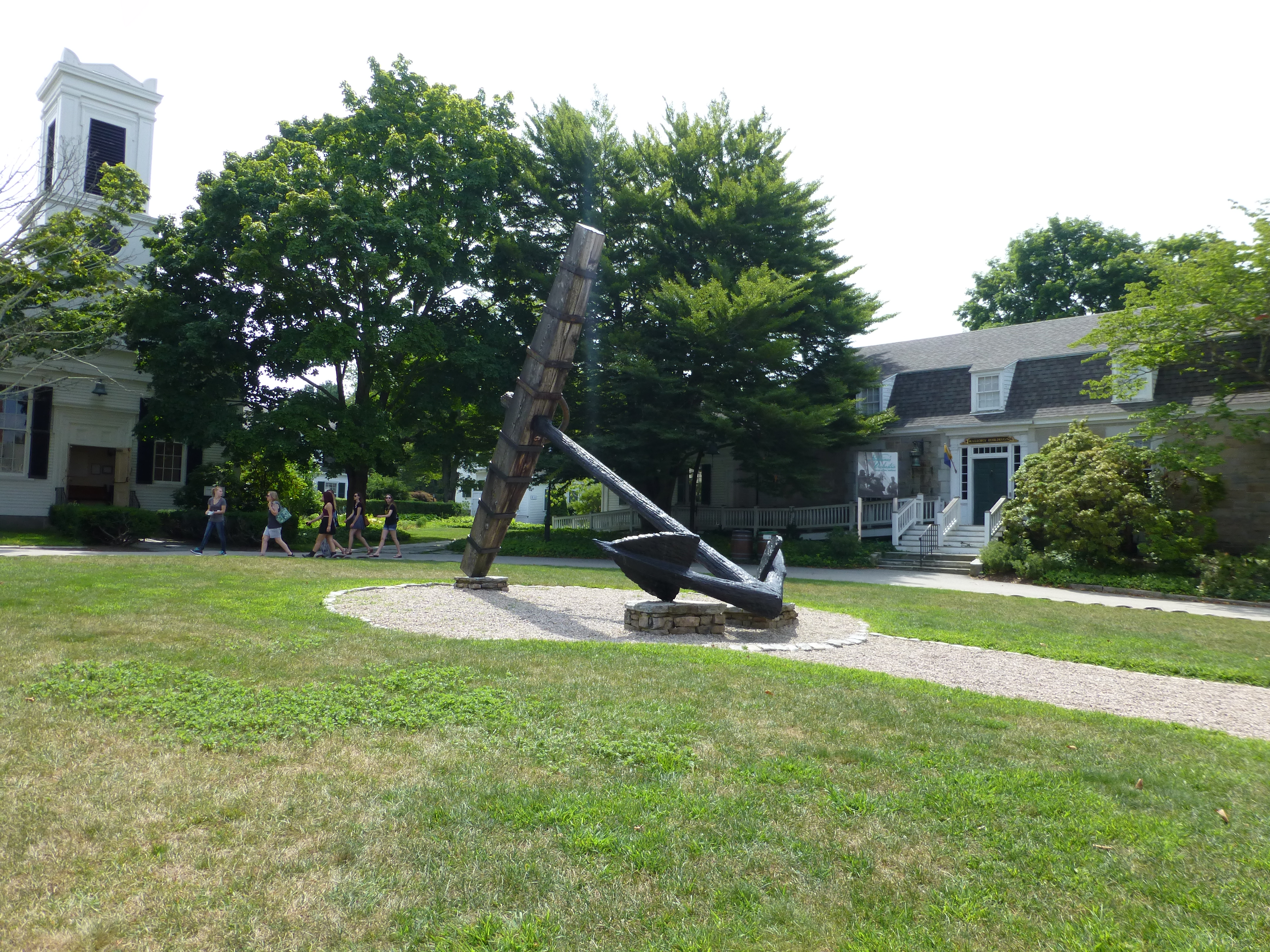
First, everyone should visit Mystic Seaport if able. Well worth the trip. However, if coming by sea it is worth noting that the information on their web site is well out of date.
Discrepencies:
The web page claims that the dock attentends are on duty 9am-7pm. Nope. They close at 5pm.
The 2014 boaters guide informs us that we must depart by the 12:40 Mystic River Bascule Bridge opening. Nope. 11:40 is the time.

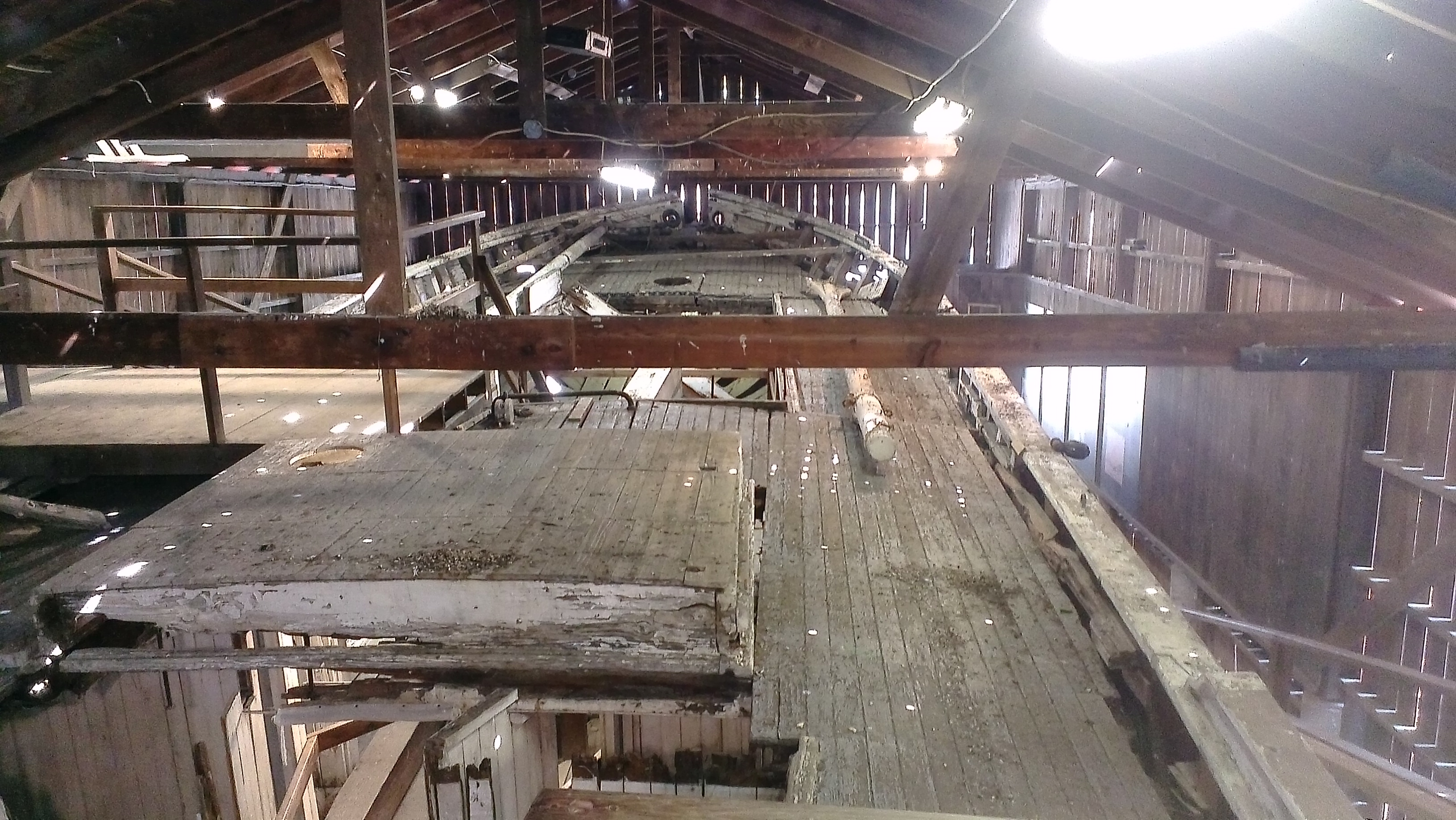
Mystic Seaport: I believe this is the derelict schooner Australia.
The courtesy van with service to local grocery and marine supply stores simply doesn’t exist, and apparently hasn’t for years.
Showers are fine. And there is a coin operated washer and dryer for laundry; but it is all the way on the other side of the grounds near the Shipyard.
We did manage to get a taxi to take us to the grocery store for provisions, and also marina visitors are allowed after hours access to the grounds, which is cool.
Day 20 (August 6, 2014): Old Saybrook
Adam's Spot
 Latitude:41.28891
 Longitude:-72.36224
 GPS location Date/Time:08/06/2014 19:21:54 EDT

 Message:avoid tstorms. free mooring in Old Saybrook.

 Click the link below to see where I am located.
 http://fms.ws/ITHl5/41.28891N/72.36224W
 Unfortunately, we were only able to enjoy Mystic Seaport while officially open and running for two hours before hurriedly jumping on the boat and doing all we could to make the bridge opening.
Given a choice, we would have stayed another night. Unfortunately, vacation time is rapidly disappearing and we need to make miles heading home. Too bad, as the Charles Morgan (the last remaining whaling ship) was returning to the seaport later in the day, and the Seaport and the town of Mystic were making a big deal of it. We did get to see the Morgan heading in, however. Sadly she wasn’t under sail. Too bad.
Seeker docked at Mystic Seaport
We made it to North Cove in Old Saybrook for the night. This is a tight little place full of moorings. Happily, a sign outside the harbor informed us that it was a Harbor of Refuge and we were free to pick up any vacant mooring with a yellow streamer. We did just that. We tried to eat dinner outside, but the mosquitoes found us so we put up the screens and retired below for the evening. A great many fish were jumping all night. I presume they were feasting on the flying devils that were trying to feast on us.
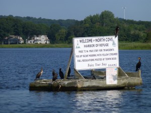
“WELCOME to NORTH COVE HARBOR OF REFUGE Free 72 Hr. Max stay for transients. Pick up vacant mooring with yellow streamer. Full regulations posted at town dock. Enjoy Your Stay. O.S.H.M.C.” Thank you. We did.
Early to bed.
Day 21 (August 7, 2014): Bridgeport, CT
Adam's Spot
 Latitude:41.16078
 Longitude:-73.17166
 GPS location Date/Time:08/07/2014 18:54:46 EDT

 Message:anchrd off abndnd pleasure beach, Bridgeport.

 Click the link below to see where I am located.
 http://fms.ws/IUbZX/41.16078N/73.17166W
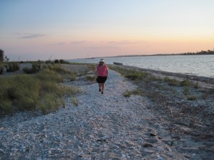
Adam and Lauren at the beach of the no longer abandoned “Pleasure Beach”
We planned to leave by eight. Managed to get out by nine. Not too bad for us.
Tried to sail. There was wind; but it was coming from exactly the wrong direction. Of course. We could sail, tacking up and down the sound; but vacation time is waning and we need to get back. So we motored.
I’ve never motored so much. Ugh.

Seeker saying “Good-night” to the sun, Pleasure Beach anchorage (7 August 2014)
But it was a pleasant (if long) day, anyhow.
We are anchored off what we thought was the abandoned Pleasure Beach amusement park near Bridgeport, CT. It turns out the city of Bridgeport has rebuilt the place, with a new boardwalk and pavilion. Access is by free water taxi. The place looked nice, although it loses bragging rights now that it isn’t a ghost town.
Another long day is planned for tomorrow. The wind looks to be more useful, though.
Day 22 (August 8, 2104): Port Washington, NY
Adam's Spot
 Latitude:40.82909
 Longitude:-73.70819
 GPS location Date/Time:08/08/2014 21:21:06 EDT

 Message:Port Washington tonight. Lady Liberty tomrw.

 Click the link below to see where I am located.
 http://fms.ws/IW6Ye/40.82909N/73.70819W
Listing to Starboard at low tide. (0342 in the early AM on 08 August 2014)
I woke up around 0300 to silence a slapping halyard and noticed that the boat was not sitting right. In fact, we were sitting decidedly bow down. Apparently we anchored too close to shore. Happily, I noticed this at just about dead low water, so we didn’t end up completely high and dry. For awhile we seemed to be balanced on the keel; but we eventually felt the sickening feeling of the boat listing to starboard. No damage done. By morning we were again afloat and ready to head out.
We made it to Port Washington about mid afternoon, and grabbed a free mooring. Port Washington permits free use of some of their moorings for two days during the week, and one day during a weekend, after which I believe it is a reasonable $25/night (including launch service).
It was a pretty long row to the dinghy dock (damn, I really think I might need an outboard motor), so we called the launch ($8/person round trip) to take us in to shore. We were over due on the oil change, and I needed some supplies to make it happen, so we grabbed what we needed at West Marine, grabbed a really good restaurant dinner, and did some much needed provisioning. We bought enough stuff that I think my arms may have stretched a couple inches! We made it back to the boat a little after 2100.
Day 23 (August 9, 2014): Liberty Park, Jersey City, NJ
Adam's Spot
 Latitude:40.69587
 Longitude:-74.06381
 GPS location Date/Time:08/09/2014 15:45:43 EDT

 Message:liberty park for the night

 Click the link below to see where I am located.
 http://fms.ws/IX5hC/40.69587N/74.06381W
A benign Hell Gate, heading for the East Passage around Roosevelt Island
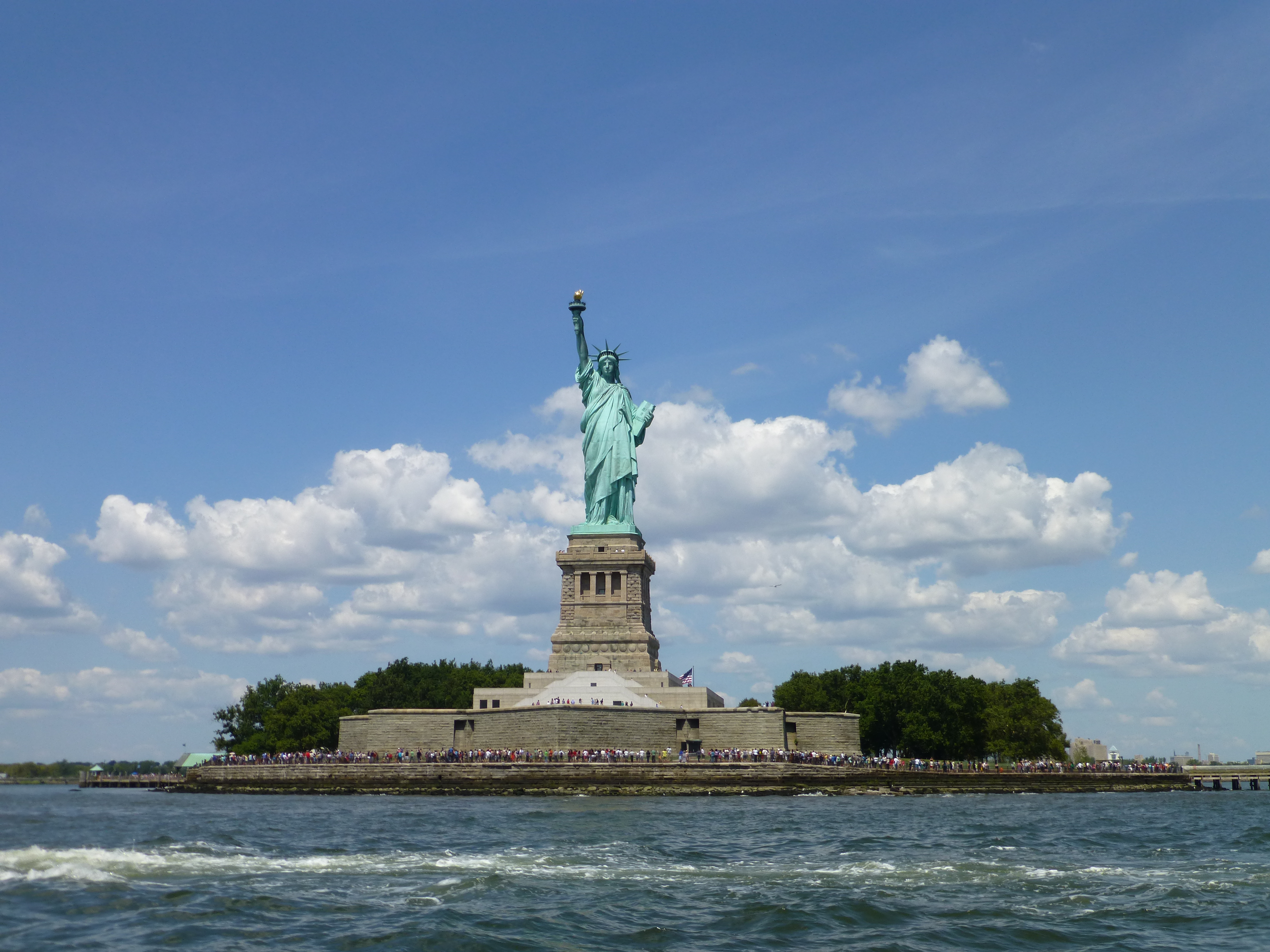
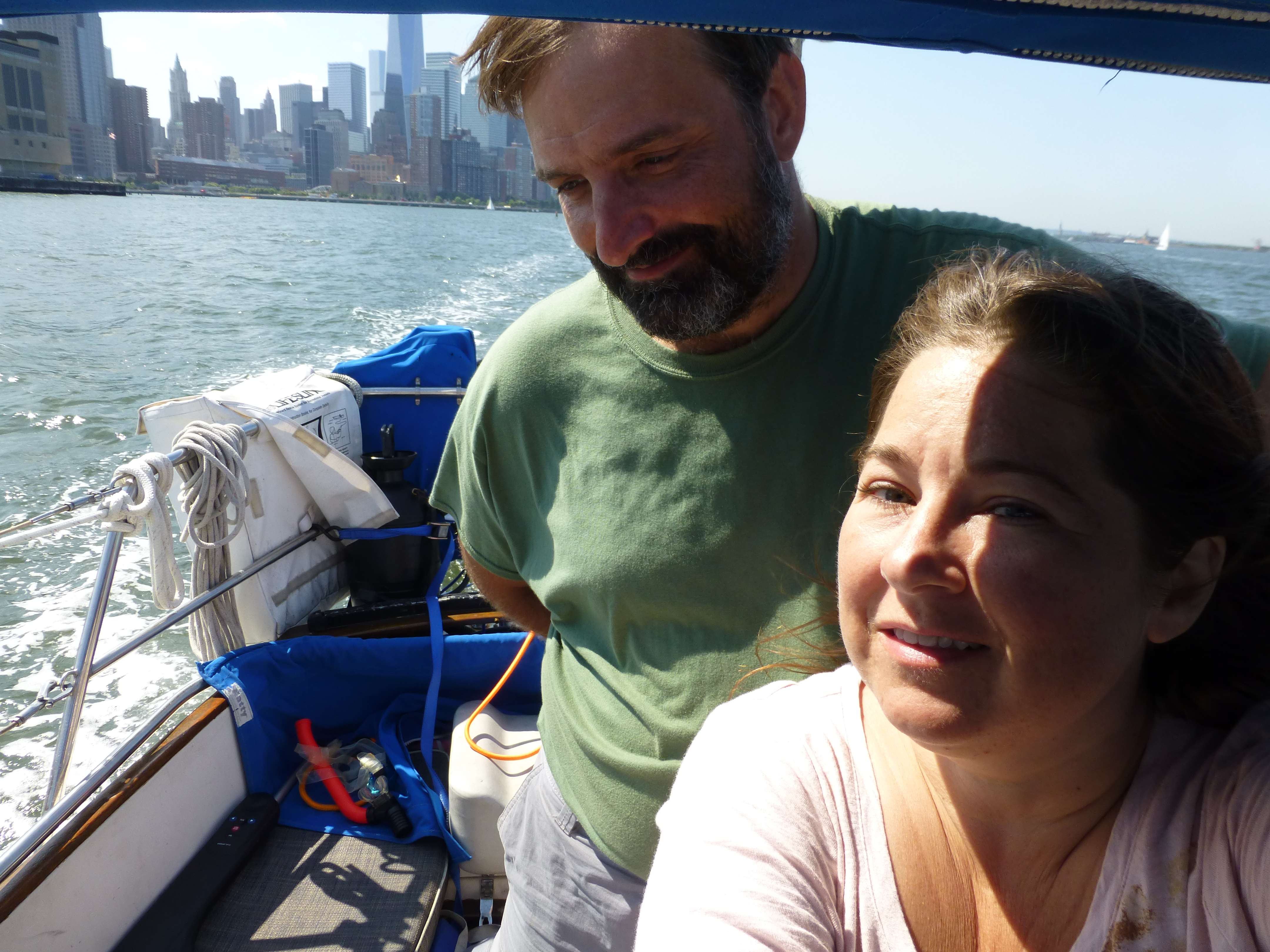
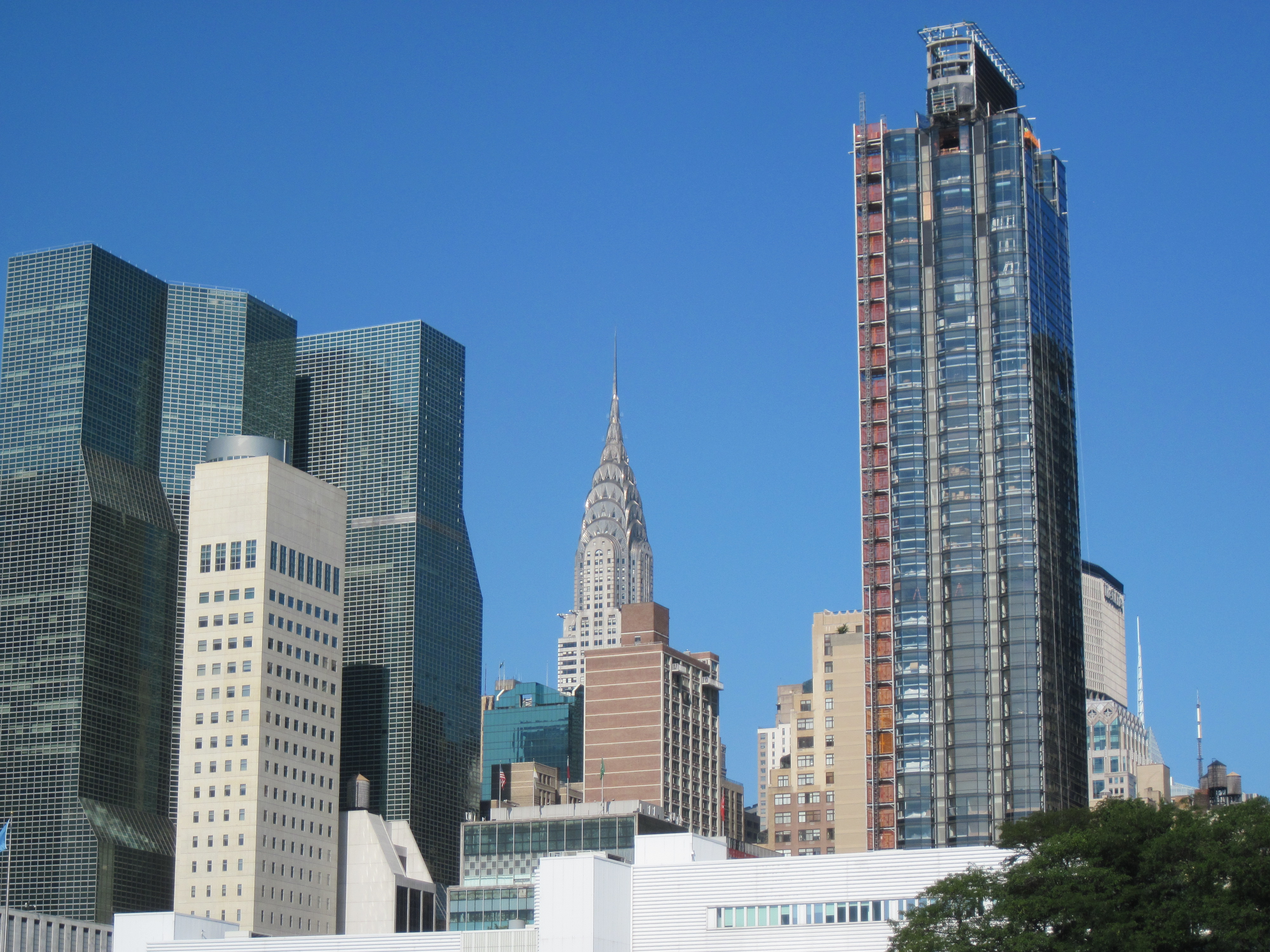
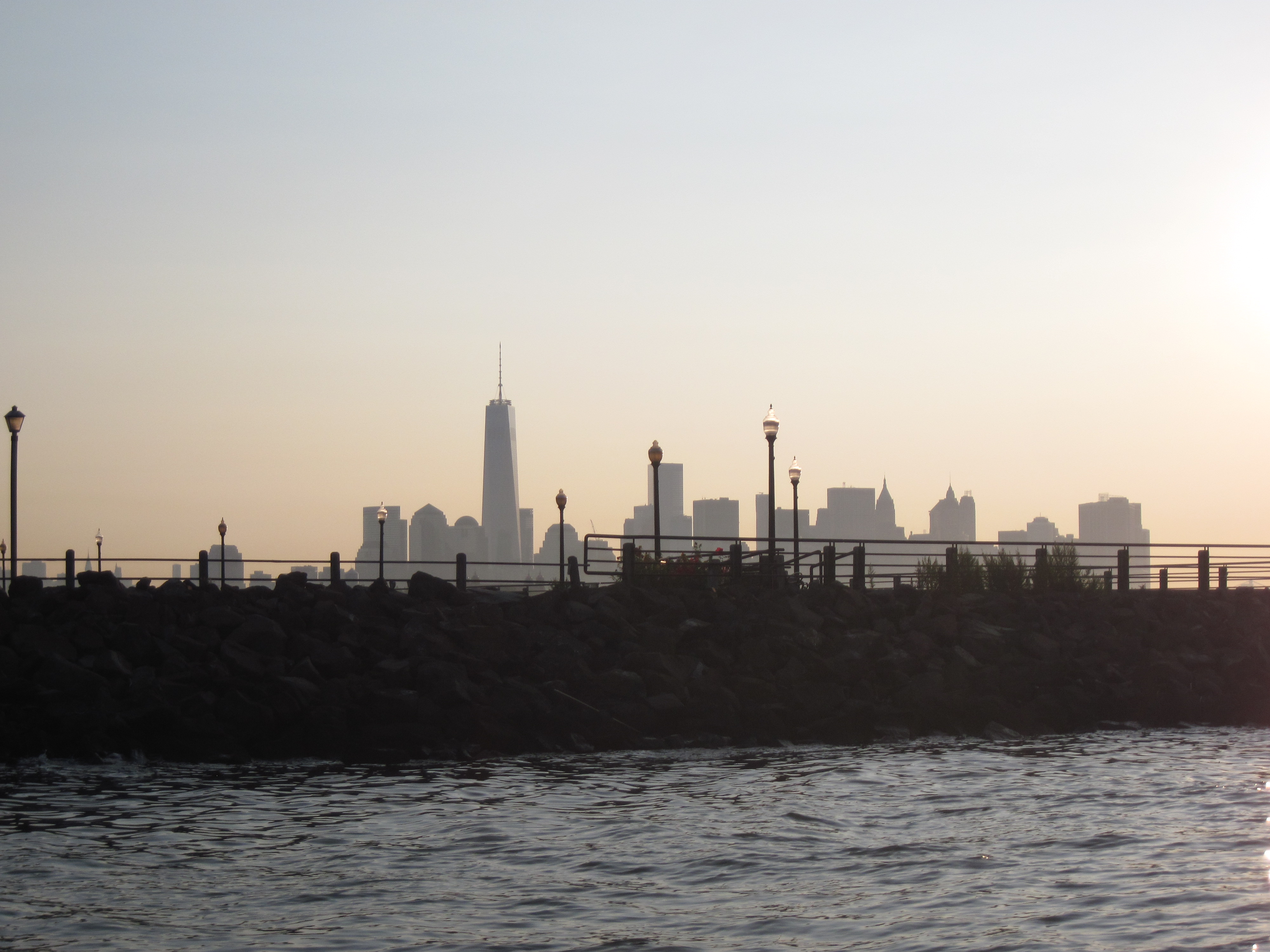
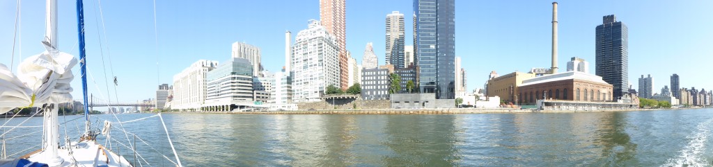
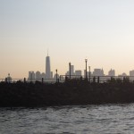
Headed out to see the big girl today. The stories of Hell Gate on the East River scared me, though, so I did a lot of research and determined the best way to go would be to hit it right at slack tide and then ride the current the rest of the way to the Hudson. And that is just what we did. Hell Gate was as flat as a back yard pond. Our passage was quick and stress free, and we were in view of the Statue of Liberty shortly after 1100. It was early yet, so we took a tour up the Hudson, exploring Manhattan from a different angle.
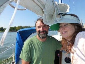
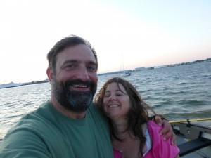
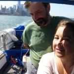
Adam and Lauren in New York
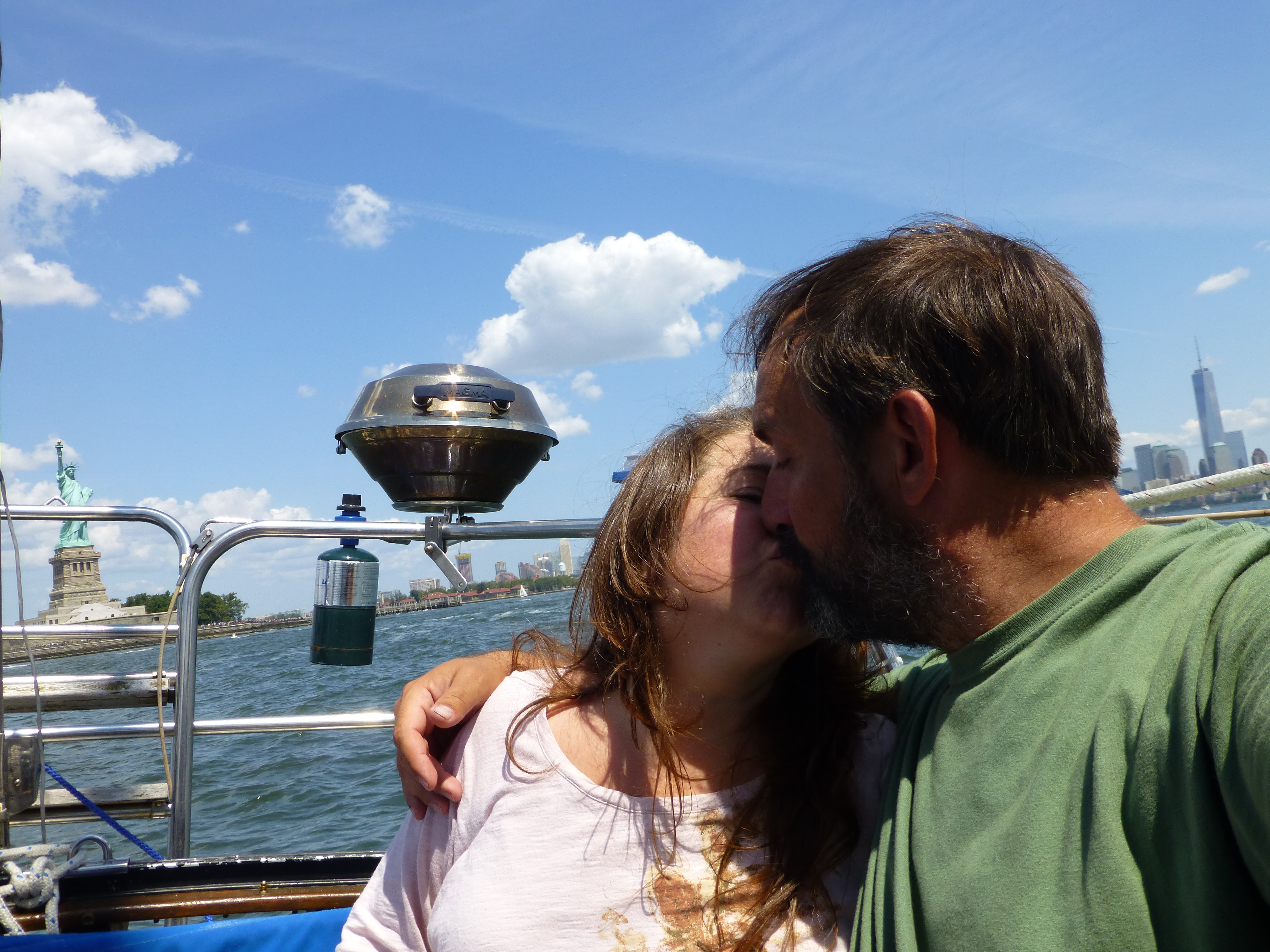
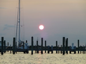
We picked up fuel at Liberty Landing Marina, and went for a close up visit to Lady Liberty. It was a bit rough with all the boats around; but we got a few good photos, including one by request for Brian Kretchman. Brian owns Kretschmann Brewery and desired a shot of one of his growlers next to the statue. We were happy to give him his shot.
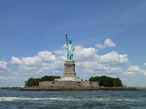
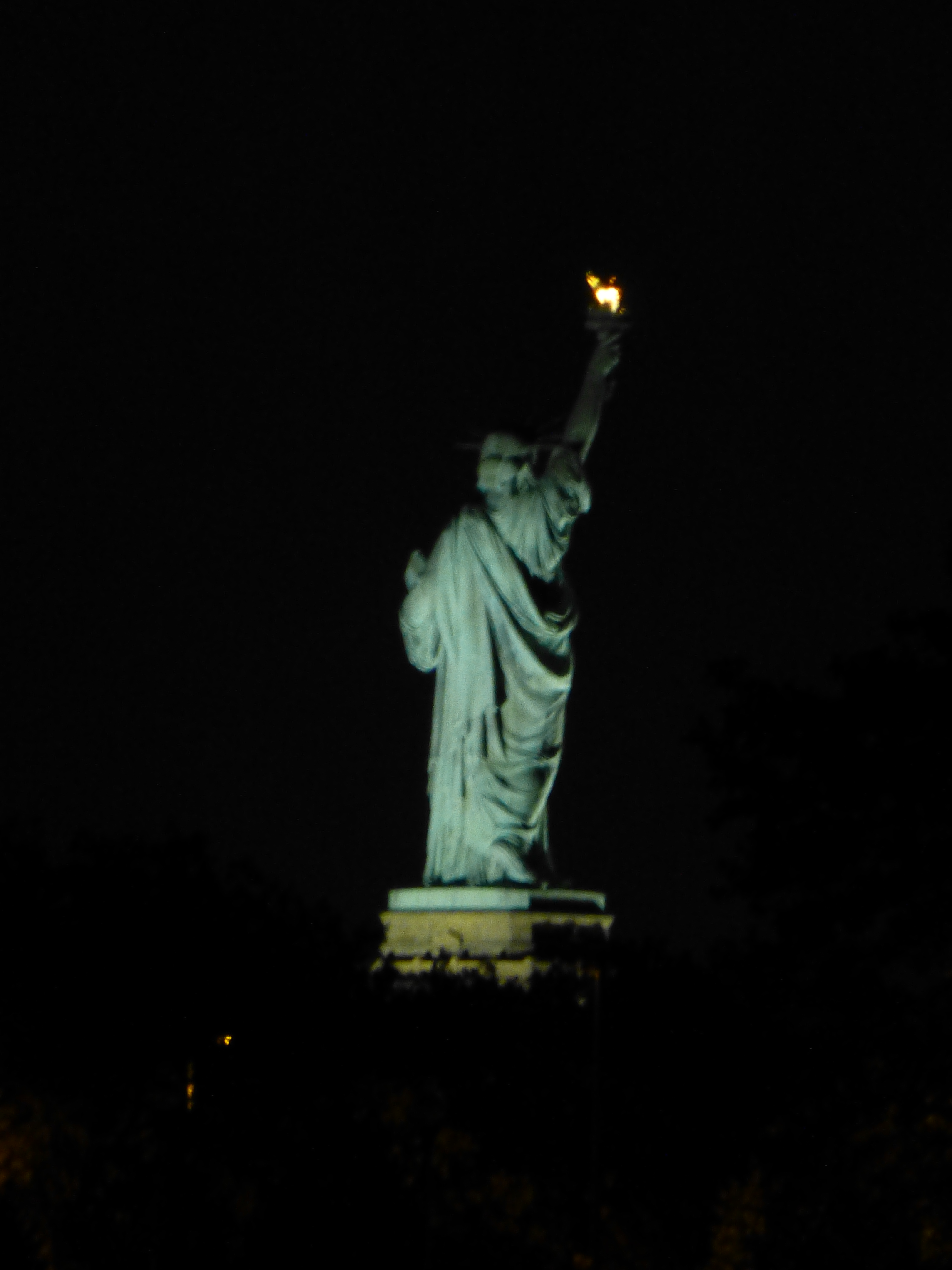
Lady Liberty (9 August 2014)
The intent was to anchor right next to the statue; but the motion of the ocean was a little too much, with all the ferries, tour boats, and general idiots running about. So we sucked in to an alternate spot behind Liberty Park. There is a smallish anchorage there that can handle a handful of boat. But it is secure, and we still maintained a decent view of the statue.
I was very disappointed to find out that our SPOT had choked and not recorded our tracks. Very. Disappointed. I had to pull the batteries and reinstall to reboot the blasted thing.


Day 24 (August 10, 2014): Liberty Park, Jersey City, NJ
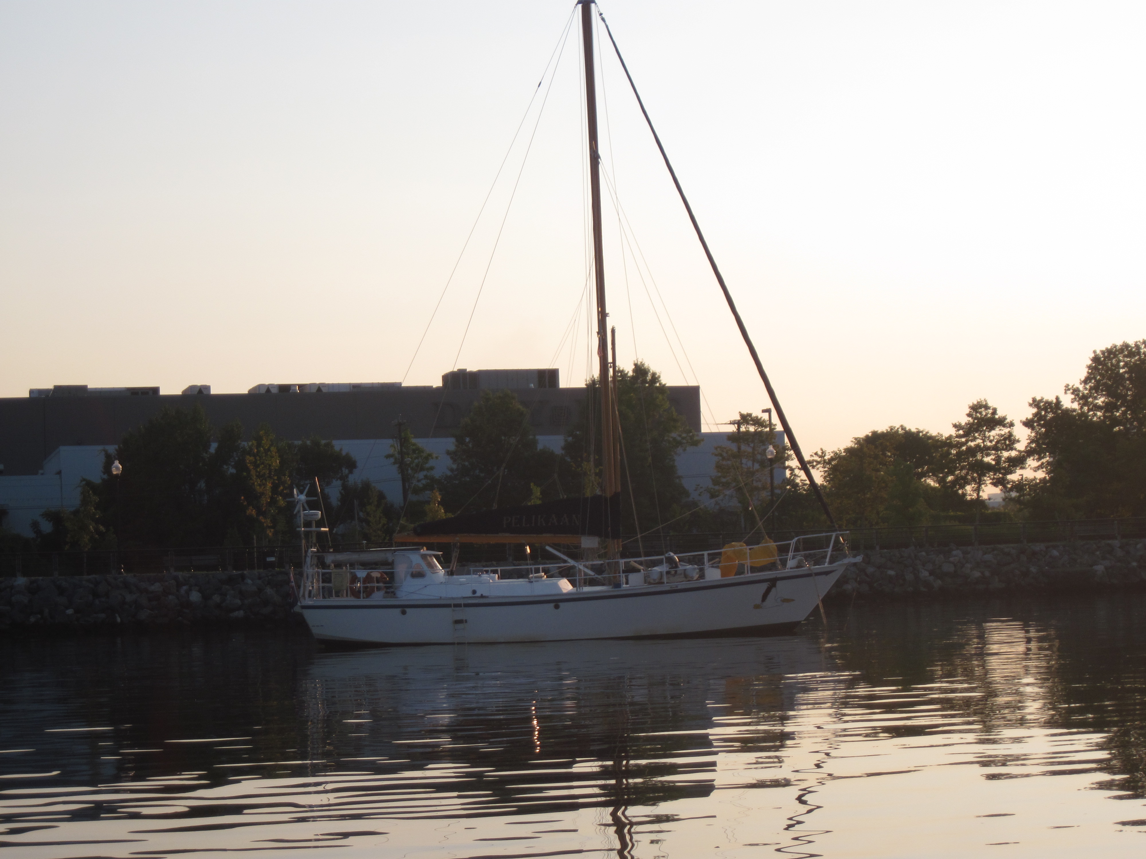
I changed the engine oil. We hung around with Miss Liberty. We had drinks with an interesting couple who had sailed from Sydney Australia (Hans and Fien on Pelikaan). And we did a little walking and rowing and reading and napping and not much else.

Day 25 (August 11, 2014): Barnegat Bay, NJ
Adam's Spot
 Latitude:39.76175
 Longitude:-74.11694
 GPS location Date/Time:08/11/2014 19:23:51 EDT

 Message:barneget bay to hide from tomorrow's tstorms.

 Click the link below to see where I am located.
 http://fms.ws/IZvuM/39.76175N/74.11694W
There is a weather system in the forecast, so a straight shot to Cape May doesn’t seem practical today. We discussed our options, and figured our best bet was to make it half way, more or less, to Barnegat Bay. The stories I have heard about the Barnegat Bay Inlet made me nervous (recurring theme, apparently); but we didn’t want to wait three days and then have to press crazy hard to get home in time to get me back to work.
 We motored, hard, and managed to get to the inlet near slack. We called TowBoatUS for information, and went for it. It was a bit bumpy getting in; but wasn’t too terribly difficult, although having to dodge a SCUBA diver during the roughest stretch annoyed me. Crazy bastard almost got himself killed! His boat with the divers flag was well outside the inlet.
We followed the day marks and made it to an anchorage not far from Barnegat Light House. There was a lot of wind, and the current was wicked; but our Rocna anchor always sets well and we were secure. I did wake up several times to check on various noises; but outside of the boat facing the wrong way (and thus having the anchor chain rub off some of our bottom coat) all was right with the world.
Day 26 (August 12, 2014): Waretown, NJ (Barnegat Bay)
Adam's Spot
 Latitude:39.80009
 Longitude:-74.18326
 GPS location Date/Time:08/12/2014 12:16:13 EDT

 Message:in marina to wait for tstorms to pass.

 Click the link below to see where I am located.
 http://fms.ws/IanTZ/39.80009N/74.18326W
With a big line of thunderstorms due today, we thought it best to not travel much. I tried to get a marina slip near the inlet; but the only place that would take us was the High Bar Harbor Yacht Club, and they wanted $3.50/foot. So we headed deeper in to Barnegat Bay looking for a place.
 The trip in was a bit winding. I got sucked in to believing my charts over believing the actual markers which was a mistake, and we grounded in Oyster Creek Channel. We called TowBoatUS for assistance. While they were on the way, though, the tide came up a couple inches and floated us free, and we carefully made it back to the marked channel. We called TowBoatUS back and told them we were fine. Lesson learned.
We were going to try and stay at Key Harbor Marina, but after calling over and over, we finally started paying attention to the answering machine message and realized they were strangely closed on Tuesdays. So we called around and found another place not too far away called Holiday Harbor Marina that could accommodate us for $2.00/foot. They appear to mostly be a fishing/power boat marina; but they were very friendly. We were a little disheartened to hear that we were supposed to be gone by 0900 tomorrow morning as the weather forecast suggested that the t-storms would be around at least until noon. The office/fuel dock girl called the owner for us, though, and arranged for us to stay as late as noon if the storms didn’t let up early enough.
Even though it was getting cloudy, we jumped in their swimming pool. It felt great. Then as the first sprinkles started to fall we made it into their showers which are ridiculously luxurious, with private beautifully tiled showers, granite counter tops, the works. Better than our shower at home.
Unfortunately there were no restaurants within easy walking distance (especially in the rain), so we cooked a meal, and settled in for the night. We watched The Green Mile, which seems to me a perfect rainy day movie.
And the rain came down.
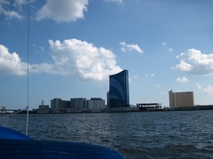
Day 27 (August 13, 2014): Atlantic City, NJ
 Adam's Spot
 Latitude:39.38054
 Longitude:-74.42206
 GPS location Date/Time:08/13/2014 17:20:55 EDT

 Message:long inland trip on NJ ICW. Anchored in AC.

 Click the link below to see where I am located.
 http://fms.ws/IcUhm/39.38054N/74.42206W
The water is very shallow except through very narrow channels
The storm had passed earlier than forecast. It was a rainy, and sometimes scary windy, night. The boat stayed mostly dry, surprisingly, although a little water came in by the mast and into one of the shelves over the double bunk. Not too bad for us. Not so good for at least one other boat in the marina that managed to sink. It was a lot of rain!
The ICW pulled us close to shore for a bit. It’s hard to see; but just on the other side of that road is the Atlantic Ocean.
The forecast for the day was calling for 4-7 foot seas with an 8 second period. To me that sounded uncomfortable. We were going to just wait near the Barnegat Bay inlet until the afternoon tide to see if the waves would moderate before doing an overnight to Cape May. Bob, the owner of Holiday Harbor Marina came over and talked to us for awhile, while we were filling up with diesel (15 gallons!?! How is that possible!) though, and suggested we take the intercoastal waterway to Atlantic City (and all the way to Cape May if we wanted). I didn’t know much about the ICW through NJ; but checked the charts and it looked doable. So off we went.

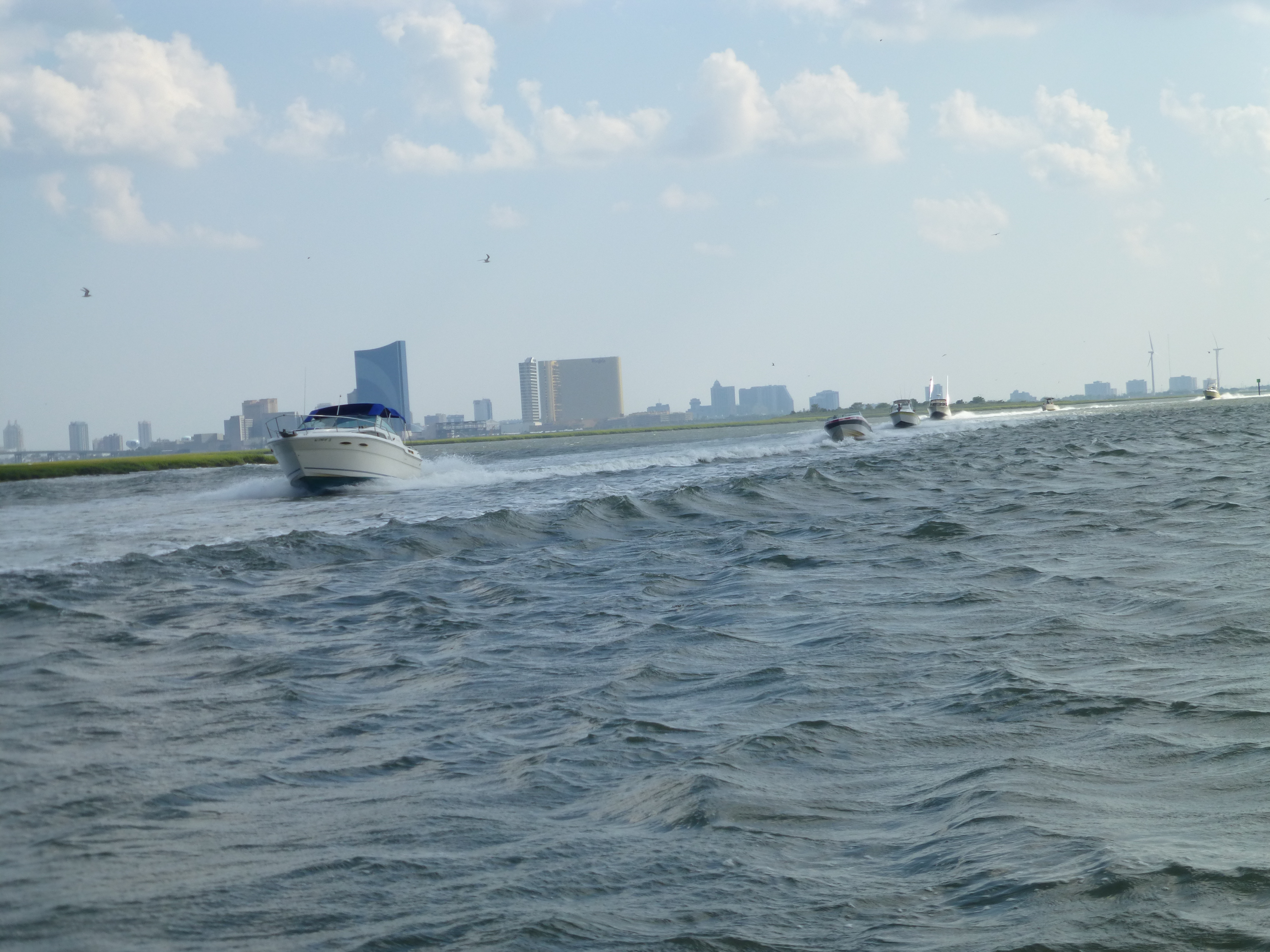
Near the end of the marshes as we approached Atlantic City, there was a non-stop line of power boats coming the other direction.
It was a narrow, winding passage. We kissed ground once when I was distracted after noticing that the SPOT tracker wasn’t tracking (damned thing doesn’t give much notice of low batteries…I really wanted those tracks!); but didn’t actually get stuck.
Getting close to Atlantic City we traversed several miles of marsh land. The flies attacked for most of our trip through this area (including one that managed its’ way up my shorts to an uncomfortable area…think Stand By Me).
 I’m glad we took the ICW. I normally would never have considered that stretch. I may never do it again. But the experience was interesting. And tiring. No autopilot through that stretch! We didn’t see a single other sailboat making the passage, either.
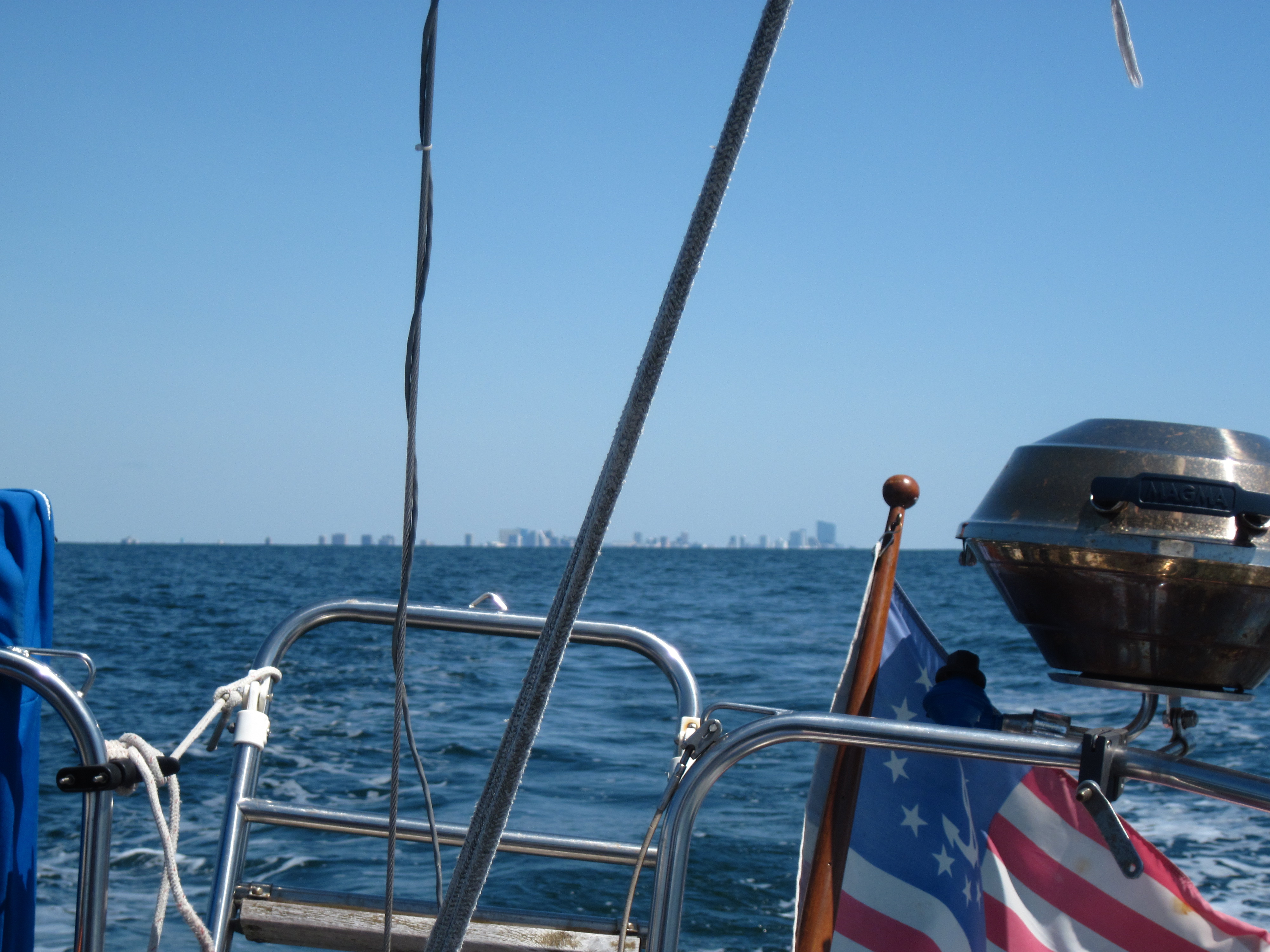
We made it to Atlantic City and anchored in front of the Golden Nugget and Harrah’s casinos. For a fairly open anchorage it was remarkably comfortable, even when the wind got up.
Day 28 (August 14, 2014): Cape May, NJ
Adam's Spot
 Latitude:38.95122
 Longitude:-74.90540
 GPS location Date/Time:08/14/2014 17:22:26 EDT

 Message:Back at Utsch's Marina in Cape May.

 Click the link below to see where I am located.
 http://fms.ws/IdrN8/38.95122N/74.90540W
Leaving Atlantic City in our wake… (19 August 2014)
It was windy in our Atlantic City anchorage. Lots of current, too. We thought we might be in for an active day on the ocean. Not so much, as the wind was significantly less impressive at sea. And for most of the day directly on the nose. Is the universe trying to tell us that we need a power boat? Yeah, even with all the motoring we’ve done, that ain’t going to happen.
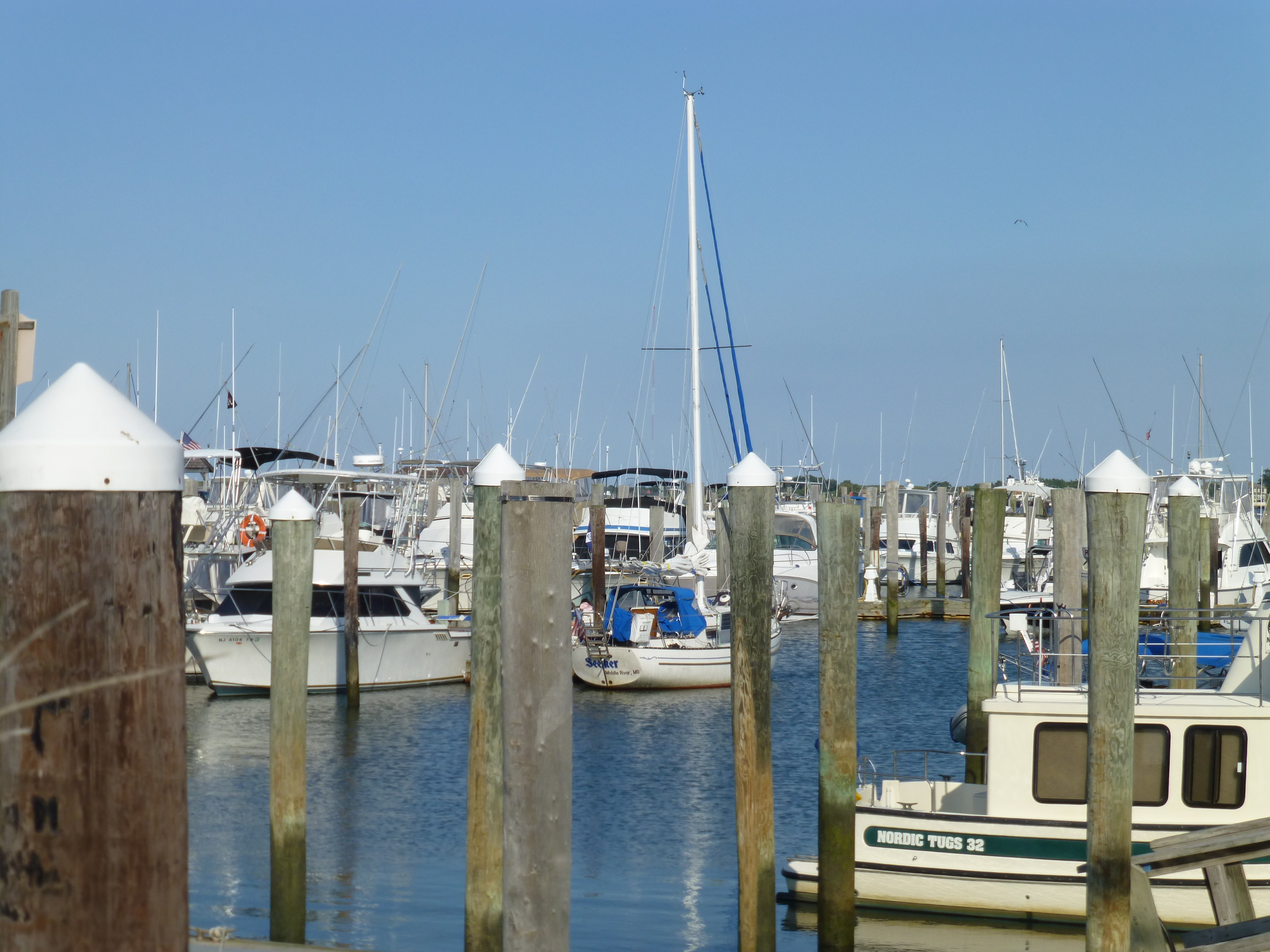
 We made it into Cape May, NJ, and grabbed a slip at Utsch’s Marina, essentially closing our Atlantic circuit right around 1700. Filled the diesel (only 7 gallons), and grabbed dinner at Lucky Bones Grille. I passed out shortly thereafter. I don’t know what Lauren did. I was out hard.
Day 29 (August 15, 2014): Cape May, NJ
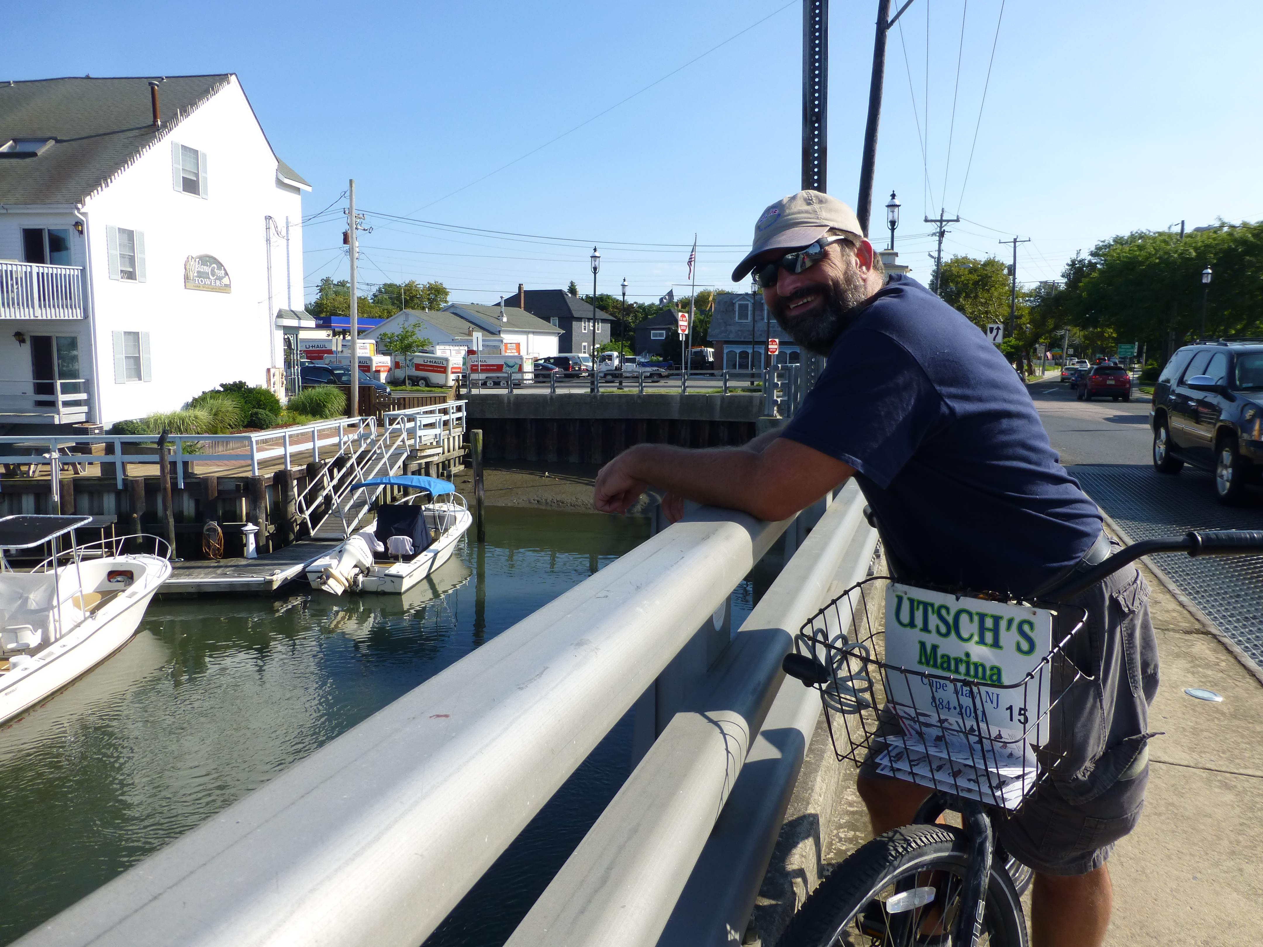
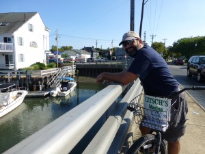
Port day. We rented bicycles and rode around Cape May. Tomorrow we leave on the tide.
Day 30 (August 16, 2014): Veazey Cove on the Bohemia River
Adam's Spot
 Latitude:39.47275
 Longitude:-75.91904
 GPS location Date/Time:08/16/2014 18:36:46 EDT

 Message:Home waters. bohemia rvr tonight. home tmrw.

 Click the link below to see where I am located.
 http://fms.ws/IgZ39/39.47275N/75.91904W
Much easier transit of the Delaware Bay this time. Motor sailed the whole way. We timed it well and had a following current all the way to our anchorage. Right around eleven hours underway. Tomorrow we should be home.
Day 31 (August 17, 2014): Middle River, MD (Home)
Adam's Spot
 Latitude:39.32420
 Longitude:-76.40076
 GPS location Date/Time:08/17/2014 16:47:47 EDT

 Message:the voyage is done. safe at home marina.

 Click the link below to see where I am located.
 http://fms.ws/Ihfnx/39.32420N/76.40076W
715 nautical miles later we return home. Unloaded the cars. Ordered Chinese. Time to veg for awhile.
Given a choice it’d leave again tomorrow.